Roads North

Lil' Squatch hit the Jackpot near the Alaskan border.

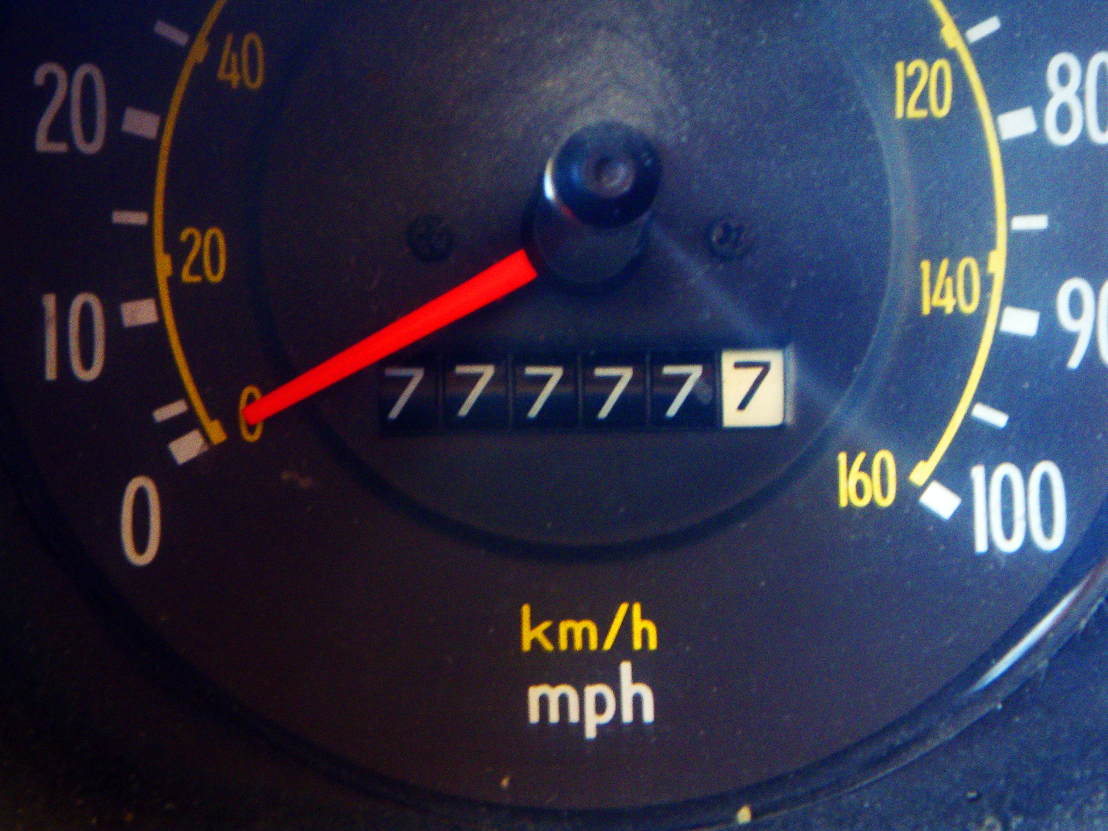
Lil’ Squatch hit the Jackpot near the Alaskan border.

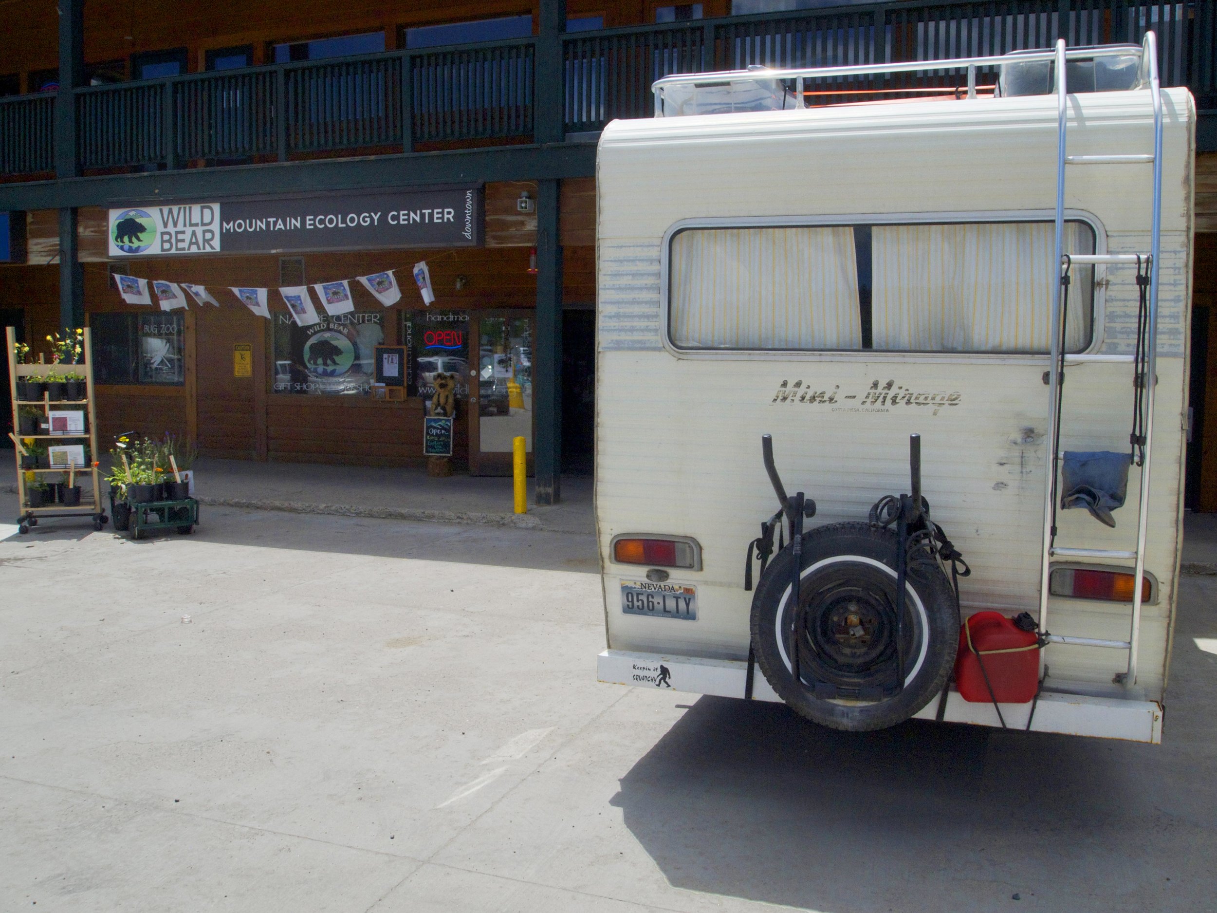
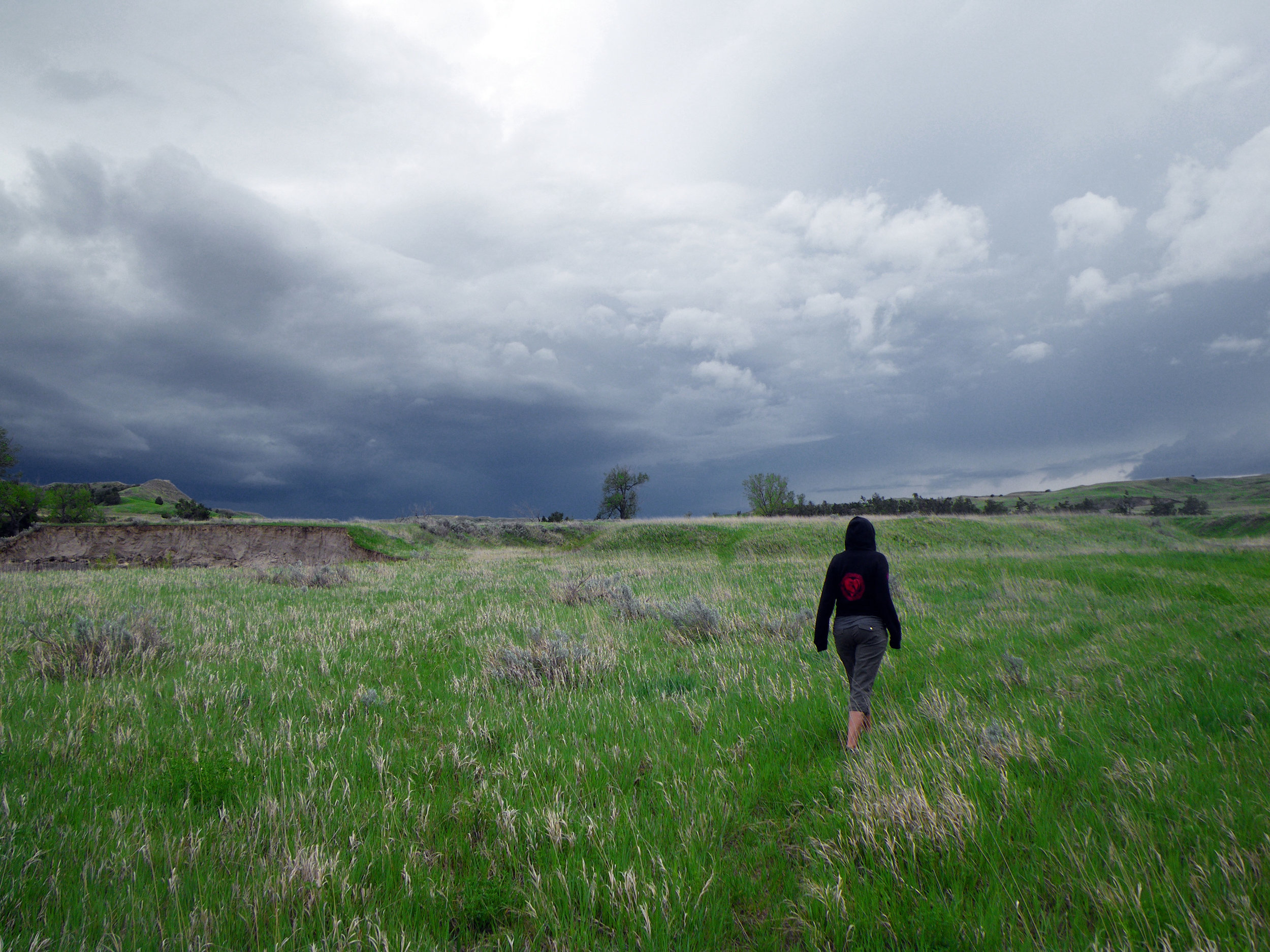
One nice thing about being the slowest little jalopy on the road is that we most often have a long unobstructed view of the landscape ahead. This also means that we sometimes have a long string of less than patient vehicles trailing behind us, but we’re considerate people and we get out of the way when there’s a chance to let folks pass. My hopes are that most people can understand the obvious limitations of our ride and that the ambiguous “Keepin’ it Squatchy” bumper sticker is less aggravating than having one that says, “I may be slow but I’m ahead of you”.

Spending a week on the Alaskan highway or “Al-Can” is giving us plenty of stretches of unobstructed views. This road was built during World War 2 in order to give better supply access to our territory in Alaska when it was otherwise much more accessible to the Japanese. It was built rather quickly by U.S. Army road crews who dealt with mud and muskegs, dense forests thick with bugs and sub- freezing conditions all while improvising the route and inventing building techniques for the tough environment. It was tough to build and tough to drive and when opened to the public after the war it became an adventurous route to the Last Frontier of the North.

Frost Heave on the Al-Can - Photo by Tim Giller

Frost Heave on the Al-Can – Photo by Tim Giller

Today the adventure is steering clear of overloaded logging trucks and oversized rigs carrying massive equipment for the oil and gas fields in remote Alberta and British Columbia. The road has been re-routed in many areas and is almost entirely paved, except in long gravel sections where road crews are busy cramming a years worth of maintenance into a short summer. The log “corduroy” across soggy permafrost and mud grades of 26% are long gone but the land refuses to hold a road in places that freeze and thaw so dramatically. Lil’ Squatch still has to dodge bathtub sized

Squatch's windshield - Photo by Tim Giller

Squatch’s windshield – Photo by Tim Giller

chuckholes and ride long miles of frost-heave rollercoaster and when tractor trailers are barreling down on you flinging gravel it’s not if you’ll get a chip in your windshield but how many.

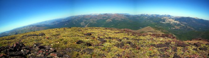
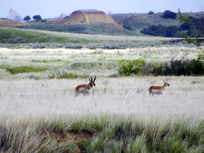
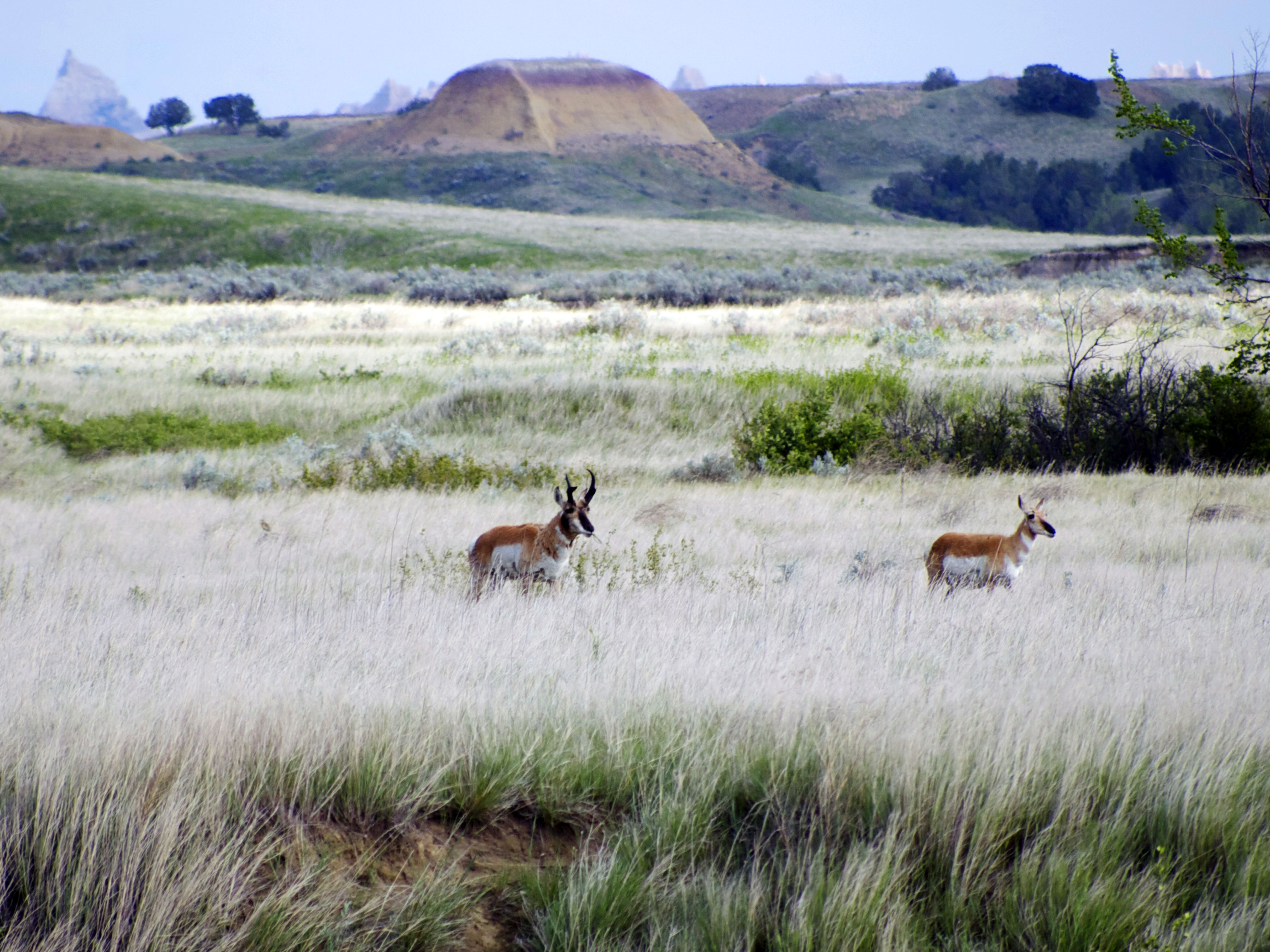
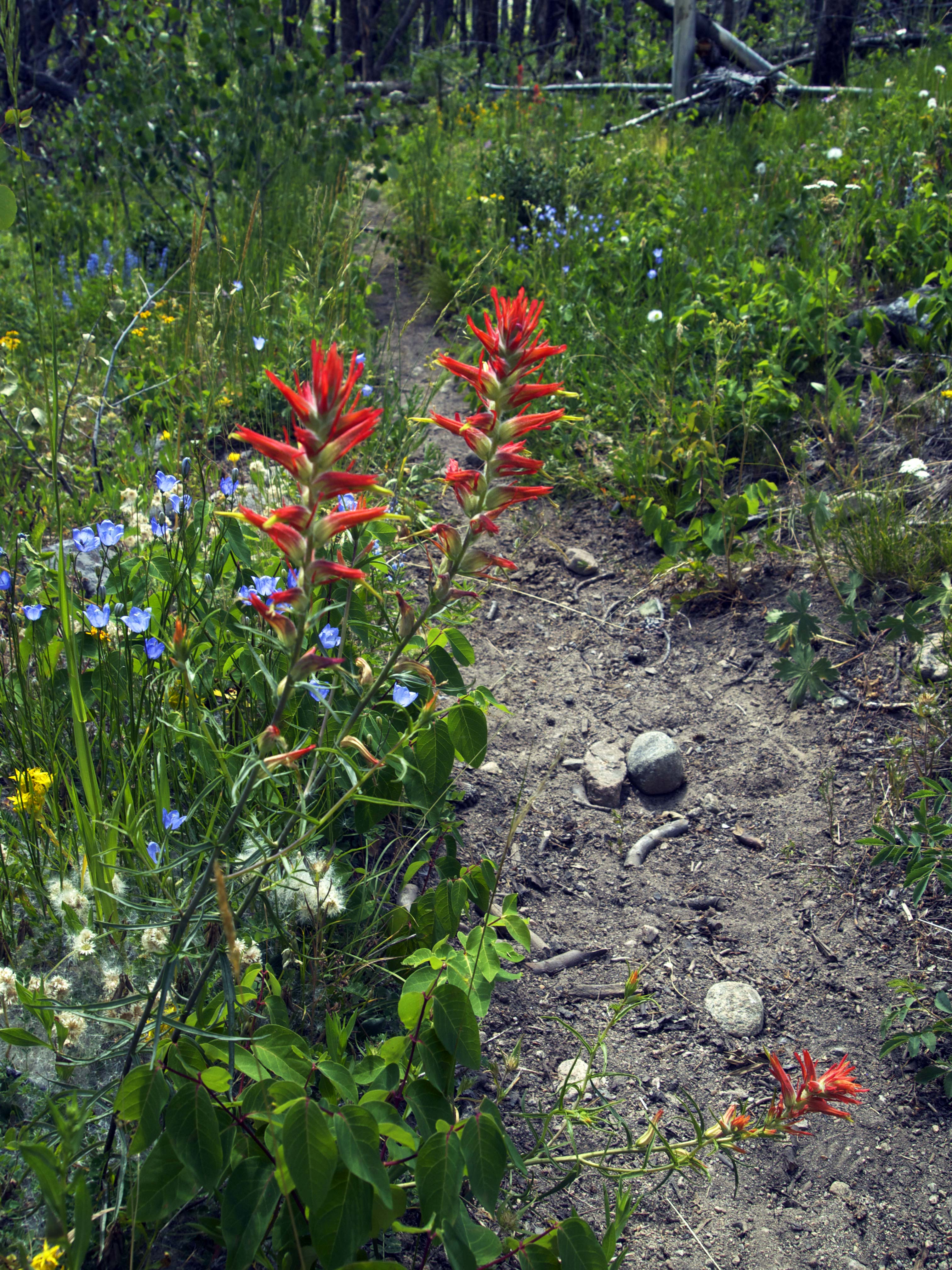
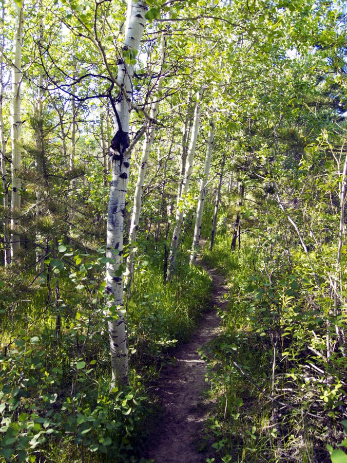
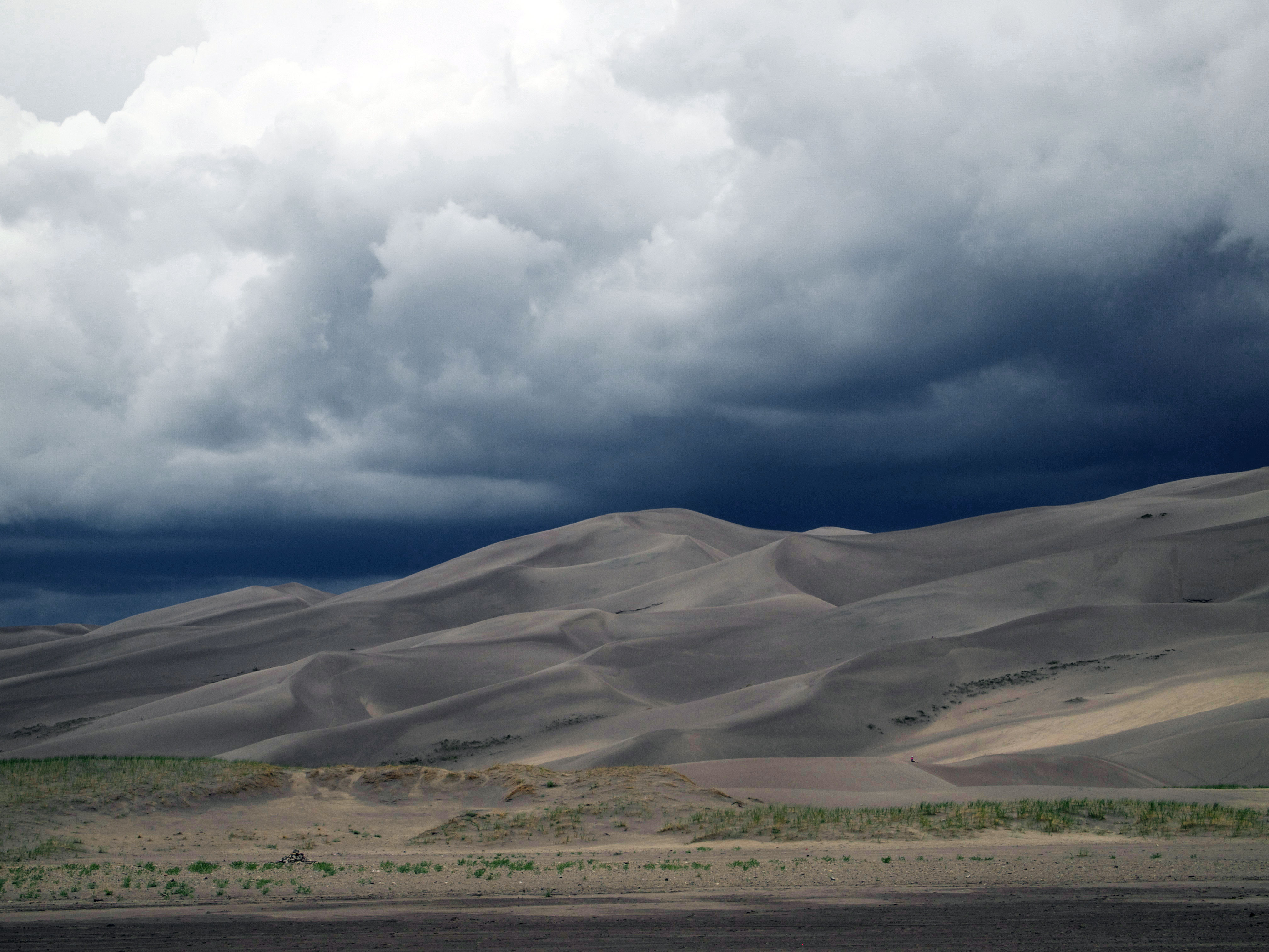
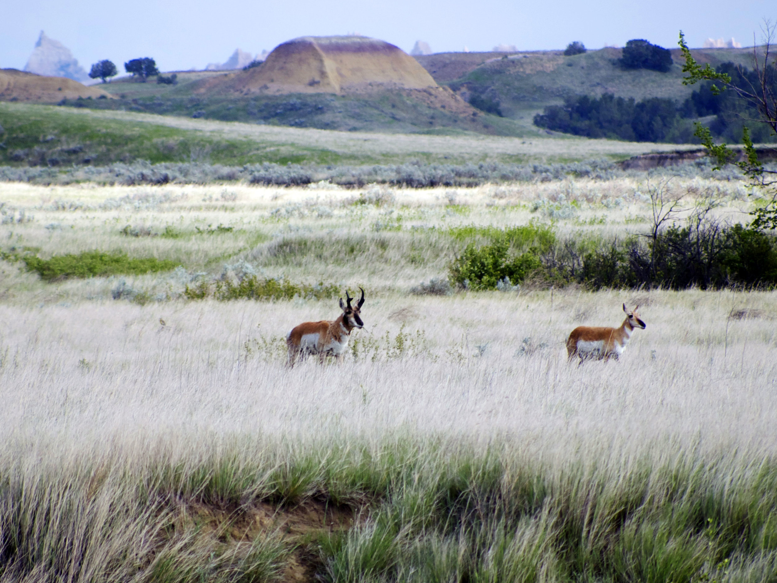
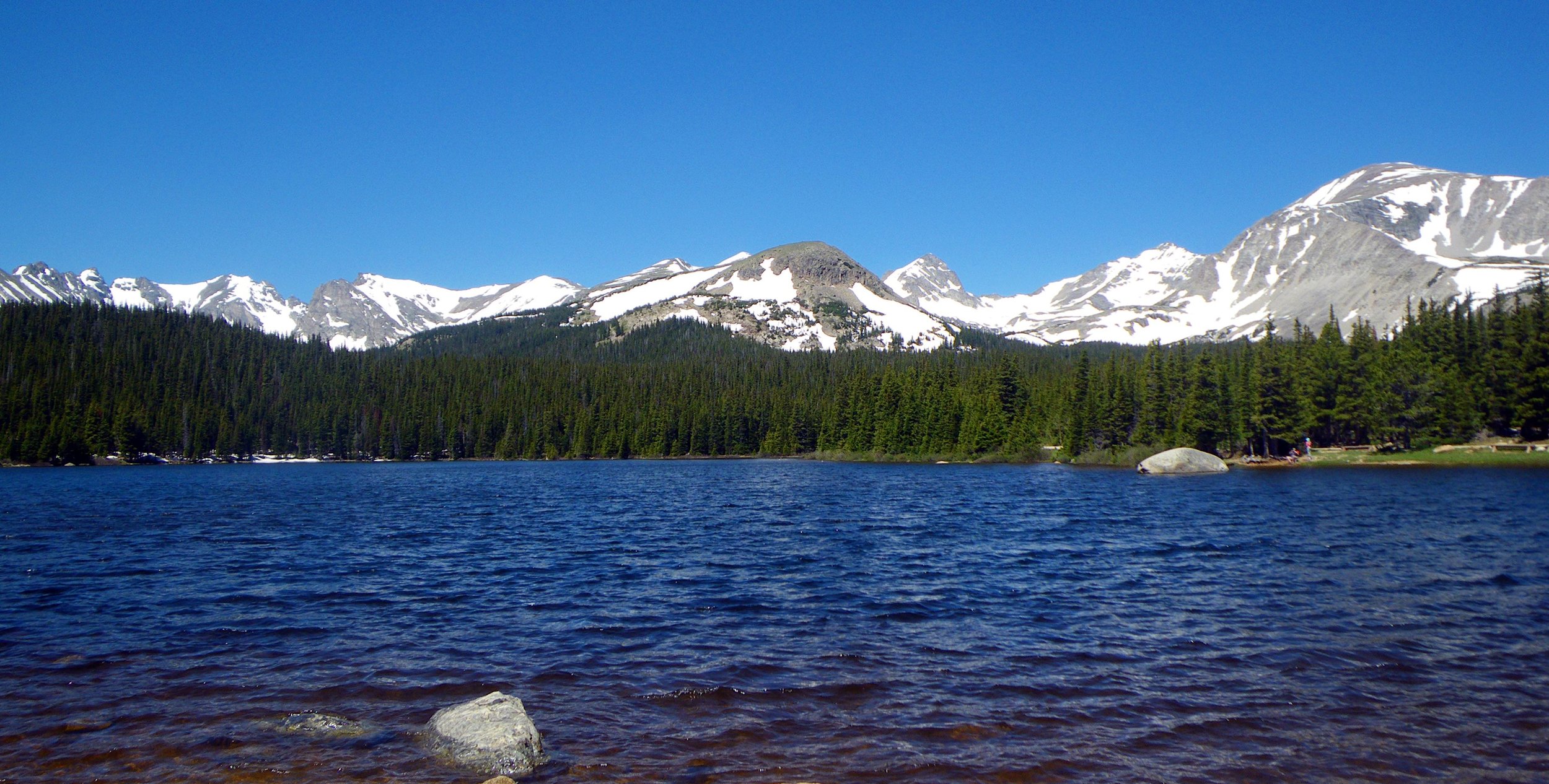
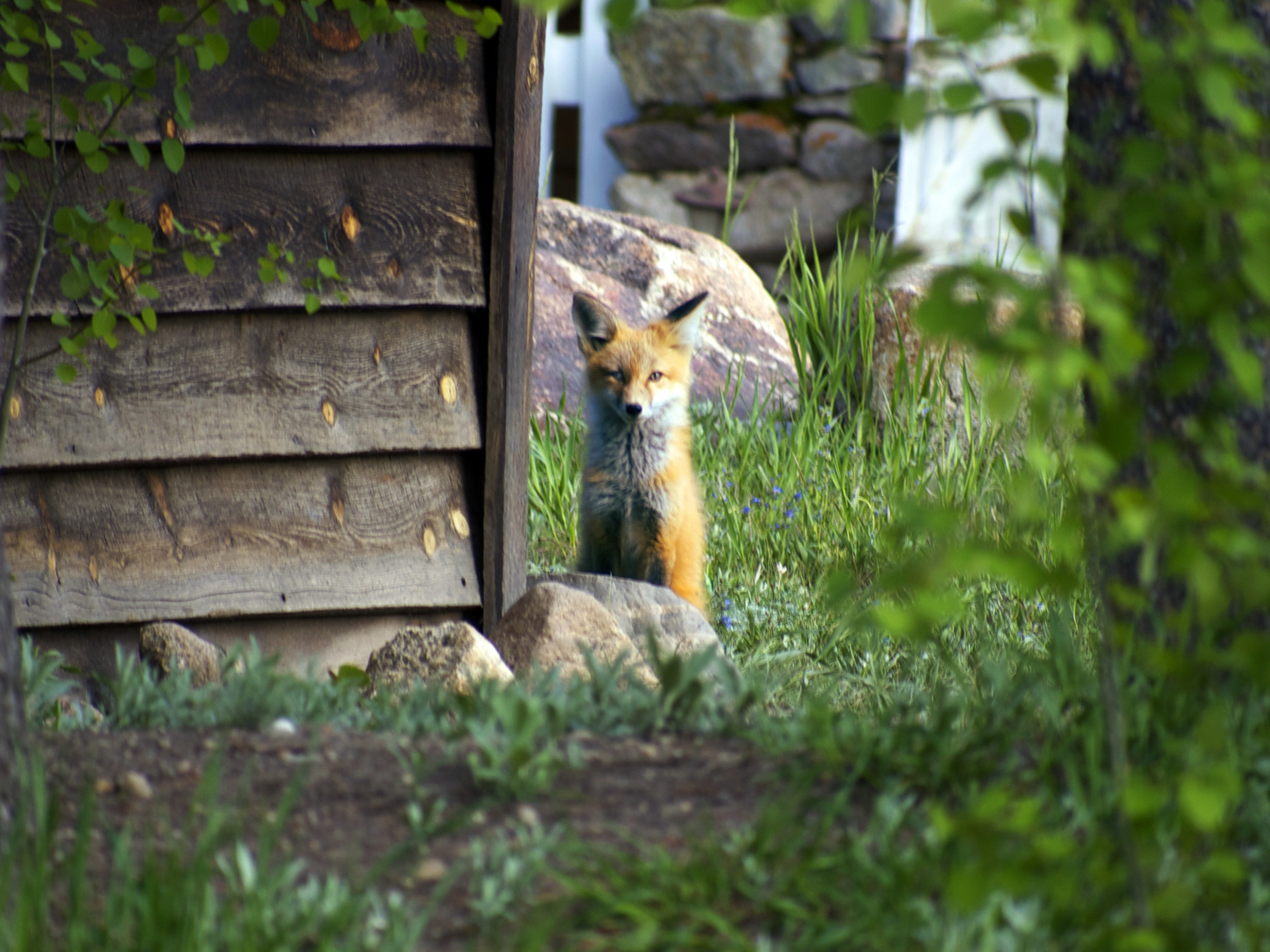
What remains remarkably wild about this journey though is the land. In these far corners of Canada and where it meets Alaska are some of the best-protected swaths of wilderness anywhere on Earth. The rush to extract from these vast acres is visible along the drive, but there is still a lot land that supports all the wildest things in North America. The Boreal Forest stretches around the northern globe as the largest ecoregion on the planet. A land for Bears, Moose, Caribou, Wolves, innumerable summer birds and all the other creatures hidden in the dense spruce. Where the road cuts through is an opportunity to see many of these animals as they come to edge zone and a 1500 mile drive means it’s almost a guarantee to spot some of them.

Roadside Grizzly, Yukon Territory - Photo by Tim Giller

Roadside Grizzly, Yukon Territory – Photo by Tim Giller

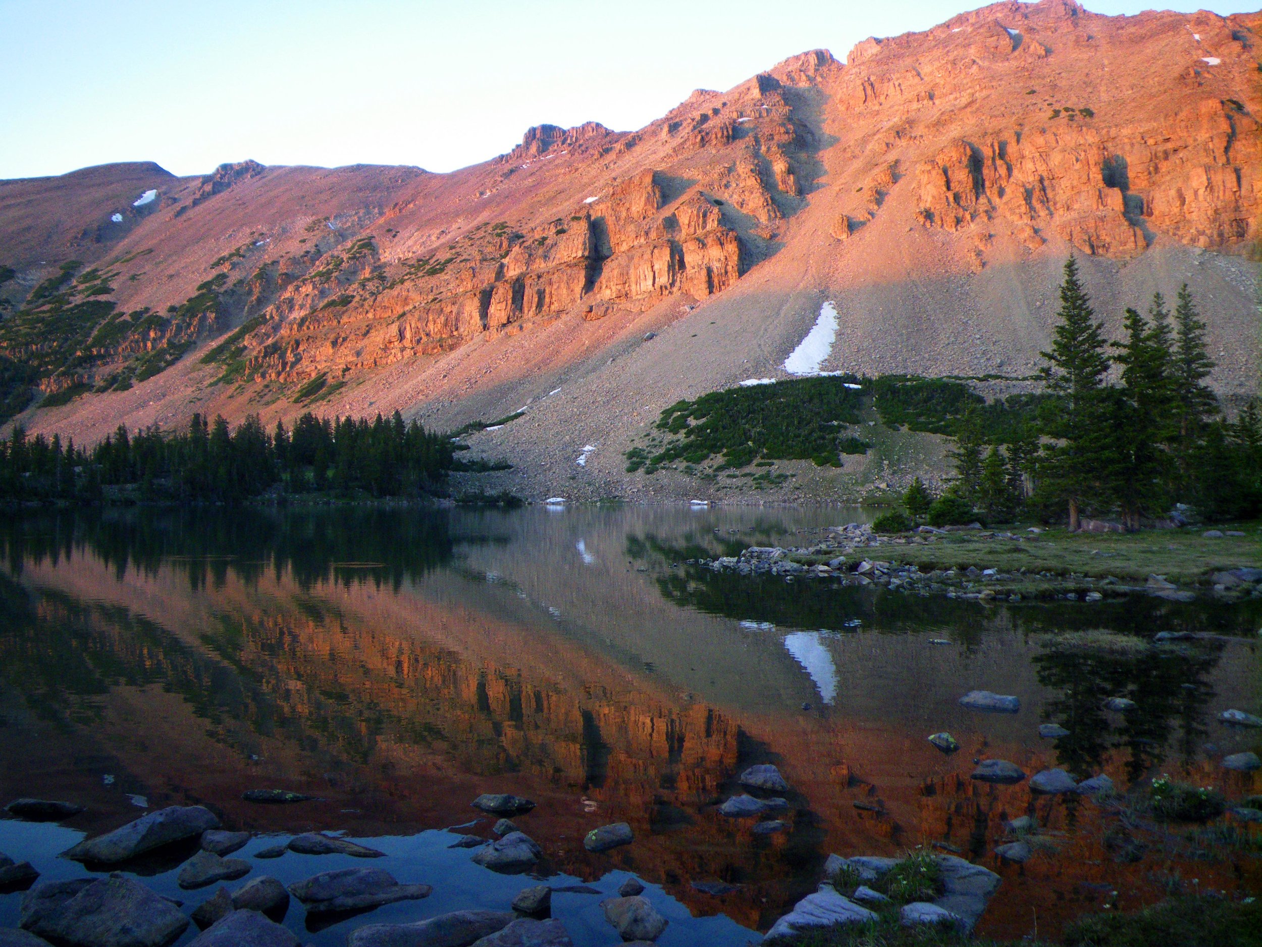
Crossing the Yukon Territory we’ve left the Rocky Mountains but to the south and west rise the biggest region of mountains on the continent. Vast icefields cling to the Kluane range with the St. Elias Mountains beyond stretching into Alaska where they bump into the Wrangells. This bent and folded land is still experiencing the powerful subduction of the Pacific plate and these mountains are still rising, the volcanoes are still smoking and the Earth still quakes with regularity.

It’s hard not to feel ambivalent about roads, especially roads that take you into wild and beautiful places. It is an incredible privilege to have access to places where you experience nature that is untamed and free. But access comes at a cost. I’ve never felt more ambivalent about a road than when I had the chance to share the drive up the Dalton Highway into the farthest north of Alaska and fulfill a long dream of seeing the Brooks Range. It is an incredible land of long tundra horizons and open country where you are free to roam across if you can endure the long miles of unstable and slow squishy ground. There I saw Dall sheep and tiny tree species that didn’t grow above the toe of my boot. I also sat for close to an hour watching a mother grizzly and her cub of the year lolling around together on the soft tussocks between bouts of digging for roots and critters. However the only reason I could be there was this road that was nothing more that an enormous piece of industrial infrastructure servicing the Trans-Alaska oil pipeline and built across the last chance we have to keep a truly immense environment intact.

Roads don’t get built so that naturalists can go visit remote places. One might argue that we have plenty of roads already. Alaska seems to have it’s own ambivalence about the issue. It’s a place that so many dream of coming to, for adventure or to try and live more directly from the land. One look at a road map of Alaska and you see right away that there aren’t many. Access to most of the remote places and to many substantial towns is by plane or by boat or in winter via snowmachine. Even dogsleds are still used. However this big land, and it really is a big land, is not inexhaustible. Roads tend to lead to more roads; access in one place creeps inevitably toward the next and every newcomer wants just one little piece for themselves. It gets played out on a complex tapestry of land use and ownership: federal, state, native, pioneer, visitor vs. local.

A generous gift from an Alaska dipnet fisherman

A generous gift from an Alaska dipnet fisherman

Our road has made a long dramatic hook into the heart of the Wrangell-St. Elias and near the end of the road we’ve come to the confluence of the Chitina and Copper Rivers. Walking out to the edge of a gravel bar, part of the extensive braided watercourses that fill the valley, we watch subsistence fishermen working their fish-wheels gathering Salmon by the basket load while glacier clad peaks rise 14,000 ft beyond. A Dutch traveler approaches us confused about the status of “easement” we are standing on. This is Native Ahtna land within a National Park. We are allowed to visit but activity is rather circumscribed, primarily to protect what is still a productive land that provides for the locals’ needs. Our traveler seems frustrated and disappointed that this wild land is not the free and lawless place of his dreams. With the exception of the first people to enter this place many thousands of years ago, it likely never was.

Fish Wheels and Mt Drum, AK - Photo by Tim Giller

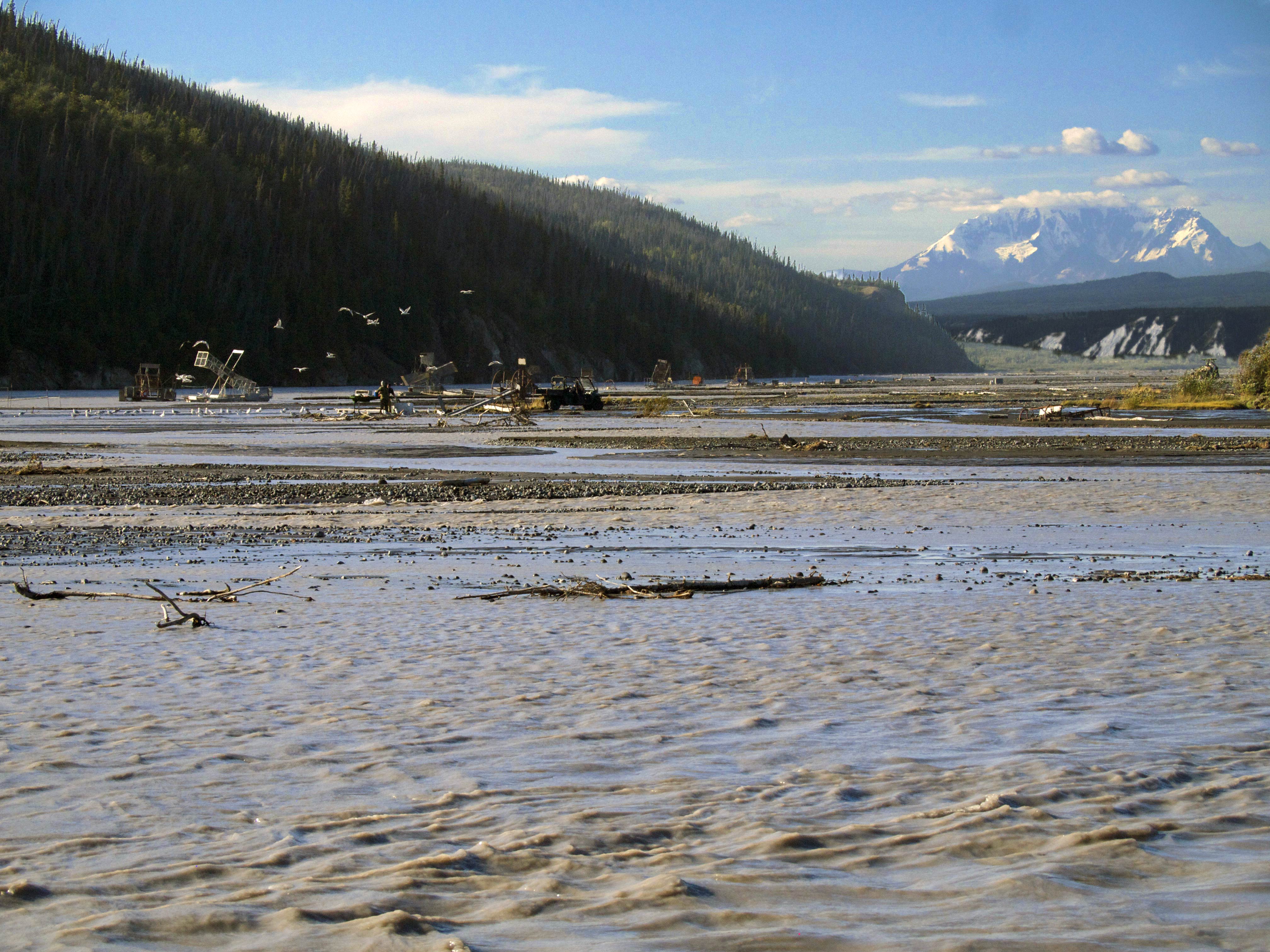
Fish Wheels and Mt Drum, AK – Photo by Tim Giller

Sharing Space

The Scapegoat Wilderness from Red Mountain - Photo by Tim GillerThe Scapegoat Wilderness from Red Mountain - Photo by Tim Giller

The Scapegoat Wilderness from Red Mountain – Photo by Tim Giller

I hadn’t walked 100 yards before I considered that maybe we should have brought two cans of bear spray. I had left our ursine strength pepper spray with Rachael at the ridgeline and hurried off alone to the top of Red Mountain.

Grizzly ScatGrizzly Scat

Grizzly Scat

When my boot kicked a cow-patty sized lump of partially dried Grizzly dung I took in my surroundings and noticed that something had been busy tearing into the stony ground to get at the roots of the low lying tundra plants on this high slope.

Grizzly DiggingGrizzly Digging

Grizzly Digging

I could see most of this wide-open country above tree line but I thought maybe I should be shouting “Hey bear!” more loudly and frequently just in case there was anything tucked into the folds of the mountain. With a stiff wind it would be unlikely that I would be heard or smelled and surprising a nearsighted animal with 4-inch claws that can weigh 500lbs or more is bad idea.

From the summit of Red Mountain, the highest point in the Scapegoat Wilderness, you can look north into one of the biggest chunks of wildland in America. The Bob Marshal Wilderness Complex, or “The Bob” includes the Scapegoat and abuts Glacier National Park, protected land stretching 150 miles to the Canadian border, with plenty of wildland on the other side as well. This is the kind of space that Grizzlies need. A male might wander over a 1000 square mile range and can be choosy about who he shares it with. The land before me is a complicated topography of dispersed jagged peaks and rounded domes with no clear central spine all rising up in a massif with innumerable valleys and grottos. I could only imagine the rich variety of wild things in there. Some I didn’t have to imagine, Elk and White-tailed deer had shown themselves on the hike in and at lakeside near our camp. A Bald Eagle was stationed in the snag above us as we picked a spot for our tent. He gave me a stern and regal look over his shoulder before flying off, clearly annoyed that we had to put our tent right there. But what else might be out deeper in this wilderness? Grizzly of course and plenty of his cousin the Black Bear. This land must be rich territory for Grey Wolves if we have the humility to share it. I love the thought of our most elusive wild creature, the Wolverine, lurking somewhere no more than a days walk away. A human days walk that is. Wolverines are obsessive and fast-paced wanderers that can cover 40 plus miles over peaks and cliffs while I’m slugging away on a well-maintained trail for 12 miles.

These creatures need elbow room. And we’ve had the wisdom to set some aside. We get into debates about owls or fish or snails but it’s never about some single species that may be on the brink. Each of these animals represents an array life that shapes the web of an intact ecosystem. Having the courage to protect a rare butterfly means that we are also protecting the life it shares space with. When we can save enough space for wide-ranging and charismatic animals it almost always means that a whole host of species gets roped in for protection. Outside of Alaska this region is one of the best we’ve got when we are ready to think big, and some of us are ready. America stakes its identity on bold ideas, democracy, civil liberties, the National Park System. Bold ideas have been shaping over the past 30 years or more of preserving the wilderness we have left and finding ways of co-existing in the places that have been or will be developed. Habitat loss and fragmentation is the most common cause of species decline and extinction. It seems that we are going to have to re-learn how to share, if only for the fact that if you take out too many of our ecological puzzle pieces the whole thing that make this place habitable may crumble away. Large scale wildlife corridors, rewilding the landscape and cross continent proposals like the Yellowstone to Yukon Conservation Initiative (Y2Y) and The Algonquin to Adirondacks (A2A) Collaborative are a just a few of the things on the table.

Pronghorn Overpass, WY - Photo by Tim GillerPronghorn Overpass, WY - Photo by Tim Giller

Pronghorn Overpass, WY – Photo by Tim Giller

While in Wyoming we learned that the state hosts the most dramatic migration event south of the Arctic. Pronghorn here migrate over 200 miles between summer grounds around Grand Teton National Park and winter grounds in the Red Desert south of the Wind River Range. Unfortunately we have been accumulating obstacles for them across the landscape like roads, homesteads, petrochemical wells and cattle fencing. Shaped by the now-extinct North American Cheetah, these are the fastest animals on the continent. They evolved to move quickly and widely in the vast open spaces of the west. They did not evolve with the need to jump. With the thousands of miles of barbed wire stretched across the cattle lands this is a huge liability. They can easily become trapped on the wrong side or entangled when trying to cross ranch land. By collaborating with ranchers and other landowners there are some simple solutions like removing the bottom row of wire or replacing it with a barb-less one. These svelte animals are quite good at slipping underneath. We can also use this liability to help them get through our lethal tangle of highways safely. A number of well-designed “animal overpasses” have been created at crucial migration points in the region. Robust fencing has been installed to funnel Pronghorn to these allowing them to avoid crossing busy stretches of road.

Pronghorn in South Dakota - Phot by Tim GillerPronghorn in South Dakota - Phot by Tim Giller

Pronghorn in South Dakota – Phot by Tim Giller

It’s hard to imagine an animal that better represents the challenges and rewards involved in sharing the landscape. Commonly referred to as the American or Pronghorn Antelope this species is uniquely American and literally in a class of it’s own. It is also a beautiful animal and respected by hunters, wildlife watchers and even ranchers. They seem to be asking so little from us in order to co-exist. In their tawny and white coats offset by the sage expanses they are visible. It as though, knowing they are the quickest thing out there, they are unafraid to be the emblem of the wild and free possibilities that are also uniquely American.

For more info on the Pronghorn migration and some wonderful photos take a look at this National Geographic article:

http://news.nationalgeographic.com/news/2009/08/photogalleries/pronghorn-antelope-migration-missions-pictures/index.html

Sharing Space

The Scapegoat Wilderness from Red Mountain - Photo by Tim Giller

The Scapegoat Wilderness from Red Mountain – Photo by Tim Giller

I hadn’t walked 100 yards before I considered that maybe we should have brought two cans of bear spray. I had left our ursine strength pepper spray with Rachael at the ridgeline and hurried off alone to the top of Red Mountain.

Grizzly Scat

Grizzly Scat

When my boot kicked a cow-patty sized lump of partially dried Grizzly dung I took in my surroundings and noticed that something had been busy tearing into the stony ground to get at the roots of the low lying tundra plants on this high slope.

Grizzly Digging

Grizzly Digging

I could see most of this wide-open country above tree line but I thought maybe I should be shouting “Hey bear!” more loudly and frequently just in case there was anything tucked into the folds of the mountain. With a stiff wind it would be unlikely that I would be heard or smelled and surprising a nearsighted animal with 4-inch claws that can weigh 500lbs or more is bad idea.

From the summit of Red Mountain, the highest point in the Scapegoat Wilderness, you can look north into one of the biggest chunks of wildland in America. The Bob Marshal Wilderness Complex, or “The Bob” includes the Scapegoat and abuts Glacier National Park, protected land stretching 150 miles to the Canadian border, with plenty of wildland on the other side as well. This is the kind of space that Grizzlies need. A male might wander over a 1000 square mile range and can be choosy about who he shares it with. The land before me is a complicated topography of dispersed jagged peaks and rounded domes with no clear central spine all rising up in a massif with innumerable valleys and grottos. I could only imagine the rich variety of wild things in there. Some I didn’t have to imagine, Elk and White-tailed deer had shown themselves on the hike in and at lakeside near our camp. A Bald Eagle was stationed in the snag above us as we picked a spot for our tent. He gave me a stern and regal look over his shoulder before flying off, clearly annoyed that we had to put our tent right there. But what else might be out deeper in this wilderness? Grizzly of course and plenty of his cousin the Black Bear. This land must be rich territory for Grey Wolves if we have the humility to share it. I love the thought of our most elusive wild creature, the Wolverine, lurking somewhere no more than a days walk away. A human days walk that is. Wolverines are obsessive and fast-paced wanderers that can cover 40 plus miles over peaks and cliffs while I’m slugging away on a well-maintained trail for 12 miles.

These creatures need elbow room. And we’ve had the wisdom to set some aside. We get into debates about owls or fish or snails but it’s never about some single species that may be on the brink. Each of these animals represents an array life that shapes the web of an intact ecosystem. Having the courage to protect a rare butterfly means that we are also protecting the life it shares space with. When we can save enough space for wide-ranging and charismatic animals it almost always means that a whole host of species gets roped in for protection. Outside of Alaska this region is one of the best we’ve got when we are ready to think big, and some of us are ready. America stakes its identity on bold ideas, democracy, civil liberties, the National Park System. Bold ideas have been shaping over the past 30 years or more of preserving the wilderness we have left and finding ways of co-existing in the places that have been or will be developed. Habitat loss and fragmentation is the most common cause of species decline and extinction. It seems that we are going to have to re-learn how to share, if only for the fact that if you take out too many of our ecological puzzle pieces the whole thing that make this place habitable may crumble away. Large scale wildlife corridors, rewilding the landscape and cross continent proposals like the Yellowstone to Yukon Conservation Initiative (Y2Y) and The Algonquin to Adirondacks (A2A) Collaborative are a just a few of the things on the table.

Pronghorn Overpass, WY - Photo by Tim Giller

Pronghorn Overpass, WY – Photo by Tim Giller

While in Wyoming we learned that the state hosts the most dramatic migration event south of the Arctic. Pronghorn here migrate over 200 miles between summer grounds around Grand Teton National Park and winter grounds in the Red Desert south of the Wind River Range. Unfortunately we have been accumulating obstacles for them across the landscape like roads, homesteads, petrochemical wells and cattle fencing. Shaped by the now-extinct North American Cheetah, these are the fastest animals on the continent. They evolved to move quickly and widely in the vast open spaces of the west. They did not evolve with the need to jump. With the thousands of miles of barbed wire stretched across the cattle lands this is a huge liability. They can easily become trapped on the wrong side or entangled when trying to cross ranch land. By collaborating with ranchers and other landowners there are some simple solutions like removing the bottom row of wire or replacing it with a barb-less one. These svelte animals are quite good at slipping underneath. We can also use this liability to help them get through our lethal tangle of highways safely. A number of well-designed “animal overpasses” have been created at crucial migration points in the region. Robust fencing has been installed to funnel Pronghorn to these allowing them to avoid crossing busy stretches of road.

Pronghorn in South Dakota - Phot by Tim Giller

Pronghorn in South Dakota – Phot by Tim Giller

It’s hard to imagine an animal that better represents the challenges and rewards involved in sharing the landscape. Commonly referred to as the American or Pronghorn Antelope this species is uniquely American and literally in a class of it’s own. It is also a beautiful animal and respected by hunters, wildlife watchers and even ranchers. They seem to be asking so little from us in order to co-exist. In their tawny and white coats offset by the sage expanses they are visible. It as though, knowing they are the quickest thing out there, they are unafraid to be the emblem of the wild and free possibilities that are also uniquely American.

For more info on the Pronghorn migration and some wonderful photos take a look at this National Geographic article:

http://news.nationalgeographic.com/news/2009/08/photogalleries/pronghorn-antelope-migration-missions-pictures/index.html

Mountain Mysteries

Amethyst Basin, High Uinta Wilderness - Photo by Tim GillerAmethyst Basin, High Uinta Wilderness - Photo by Tim Giller

Amethyst Basin, High Uinta Wilderness – Photo by Tim Giller

The Toiyabes, the Virginia Range, the Ruby Mountains. I learned from my 7th grade Nevada history teacher, Mr Gandolfo, that the state has the most distinct mountain ranges in the U.S. The Pah Rah Range, the Jarbridge Mountains, the Clan Alpine. Basin and Range. Broad valleys of sagebrush flats, a fragrant plant community of subtle color covering vast fans of alluvial outwash thousands of feet deep riding downward on enormous slabs of the Earth’s crust. The valley edges contour almost imperceptibly up to meet the abrupt escarpments of fault block ranges pushing upward. These are deep and wide valleys alternating with steep and rugged mountains are where I first encountered islands-in-the-sky. Mountain ecosystems once connected in cooler and wetter times are now separated by inhospitably dry lowlands. Trees and mammals and reptiles, evolving separately become just different enough to earn new names. Maybe someday the climate may cool again and these cousins will mix, sharing what new traits they’ve acquired.

Amethyst Lake, High Uinta Wilderness - Photo by Tim GIllerAmethyst Lake, High Uinta Wilderness - Photo by Tim GIller

Amethyst Lake, High Uinta Wilderness – Photo by Tim GIller

The Brooks Range, the Atlas Mountains, Annapurna Sanctuary. Throughout my travels, or while scanning over maps I can’t help looking at the different ranges of the world and wonder what secrets they might have, what hidden treasures are concealed in their folds and crevices. Mountains have complex topography that can only be hinted at when viewed from the flatlands below. Each acre of the Rockies has double the landmass of its prairie neighbor. Hiding behind all those ridges and inside the creases are pocket meadows, beaver ponds, rippling cascades and grotto waterfalls. The only way to know this is by going in and up. Standing knee high in the sagebrush below on a hot afternoon you might never imagine the cool aspen glades above in some hanging valley surrounded by cliffs and lying just out of your vision.

TentTent

Tent

            The Bighorn Mountains, the Absaroka Range, the Gros Ventre. When I imagined the Uinta Mountains of eastern Utah I pictured a broad hunchback of open country with low vegetation to match the rocky deserts to the south. What Rachael and I found was a cool and heavily forested extension of the greater Rockies with layered and pyramidal peaks. We spend three days hiking into the high country and it was a welcome respite from the summer heat. That heat below did generate some dramatic thunderstorms and we once again found ourselves in the midst of a hailstorm, this time with only the shelter of our nylon tent. It passed quickly though and the sun returned just in time to dry our gear.

Wind River Range, Wyoming - Photo by Tim GillerWind River Range, Wyoming - Photo by Tim Giller

Wind River Range, Wyoming – Photo by Tim Giller

The Sawtooth Range, the Calico Mountains, the Sangre de Cristos. A couple of days later while walking into the Wind River Range of Wyoming our discoveries were wildflowers. I don’t think I’ve ever seen such an abundance of flowers. They lined the trail often if a full variety of color or hillsides would be covered in an unbroken field of yellow or lavender.

Bridger Wilderness, Wind River Range - Photo by Tim GillerBridger Wilderness, Wind River Range - Photo by Tim Giller

Bridger Wilderness, Wind River Range – Photo by Tim Giller

The mixing palette included fragrance that shifted around each bend as different flowers predominated. Climbing higher into the deep canyon it was hard to resist the compulsion to see what the next bend might reveal but we had to turn back as the day was getting late. Fortunately we should have plenty of opportunities to see more mountains during the next couple of months as our path follows the Rockies into Canada and up to Alaska. There should be no shortage of surprises amidst those peaks.

Tetons, Wyoming - Photo by Tim GillerTetons, Wyoming - Photo by Tim Giller

Tetons, Wyoming – Photo by Tim Giller

Mountain Mysteries

Amethyst Basin, High Uinta Wilderness - Photo by Tim Giller

Amethyst Basin, High Uinta Wilderness – Photo by Tim Giller

The Toiyabes, the Virginia Range, the Ruby Mountains. I learned from my 7th grade Nevada history teacher, Mr Gandolfo, that the state has the most distinct mountain ranges in the U.S. The Pah Rah Range, the Jarbridge Mountains, the Clan Alpine. Basin and Range. Broad valleys of sagebrush flats, a fragrant plant community of subtle color covering vast fans of alluvial outwash thousands of feet deep riding downward on enormous slabs of the Earth’s crust. The valley edges contour almost imperceptibly up to meet the abrupt escarpments of fault block ranges pushing upward. These are deep and wide valleys alternating with steep and rugged mountains are where I first encountered islands-in-the-sky. Mountain ecosystems once connected in cooler and wetter times are now separated by inhospitably dry lowlands. Trees and mammals and reptiles, evolving separately become just different enough to earn new names. Maybe someday the climate may cool again and these cousins will mix, sharing what new traits they’ve acquired.


Amethyst Lake, High Uinta Wilderness - Photo by Tim GIller

Amethyst Lake, High Uinta Wilderness – Photo by Tim GIller

The Brooks Range, the Atlas Mountains, Annapurna Sanctuary. Throughout my travels, or while scanning over maps I can’t help looking at the different ranges of the world and wonder what secrets they might have, what hidden treasures are concealed in their folds and crevices. Mountains have complex topography that can only be hinted at when viewed from the flatlands below. Each acre of the Rockies has double the landmass of its prairie neighbor. Hiding behind all those ridges and inside the creases are pocket meadows, beaver ponds, rippling cascades and grotto waterfalls. The only way to know this is by going in and up. Standing knee high in the sagebrush below on a hot afternoon you might never imagine the cool aspen glades above in some hanging valley surrounded by cliffs and lying just out of your vision.

Tent            The Bighorn Mountains, the Absaroka Range, the Gros Ventre. When I imagined the Uinta Mountains of eastern Utah I pictured a broad hunchback of open country with low vegetation to match the rocky deserts to the south. What Rachael and I found was a cool and heavily forested extension of the greater Rockies with layered and pyramidal peaks. We spend three days hiking into the high country and it was a welcome respite from the summer heat. That heat below did generate some dramatic thunderstorms and we once again found ourselves in the midst of a hailstorm, this time with only the shelter of our nylon tent. It passed quickly though and the sun returned just in time to dry our gear.

Wind River Range, Wyoming - Photo by Tim Giller

Wind River Range, Wyoming – Photo by Tim Giller

The Sawtooth Range, the Calico Mountains, the Sangre de Cristos. A couple of days later while walking into the Wind River Range of Wyoming our discoveries were wildflowers. I don’t think I’ve ever seen such an abundance of flowers. They lined the trail often if a full variety of color or hillsides would be covered in an unbroken field of yellow or lavender.

Bridger Wilderness, Wind River Range - Photo by Tim Giller

Bridger Wilderness, Wind River Range – Photo by Tim Giller

The mixing palette included fragrance that shifted around each bend as different flowers predominated. Climbing higher into the deep canyon it was hard to resist the compulsion to see what the next bend might reveal but we had to turn back as the day was getting late. Fortunately we should have plenty of opportunities to see more mountains during the next couple of months as our path follows the Rockies into Canada and up to Alaska. There should be no shortage of surprises amidst those peaks.

Tetons, Wyoming - Photo by Tim Giller

Tetons, Wyoming – Photo by Tim Giller

Nederland Exposure

Brainard Lake, Co - Photo by Tim GillerBrainard Lake, Co - Photo by Tim Giller

Brainard Lake, Co – Photo by Tim Giller

Nederland, CO - Photo by Tim GillerNederland, CO - Photo by Tim Giller

Nederland, CO – Photo by Tim Giller

WeedsWeeds

Weeds

There is a nature center right next door to the Mountain Man Outdoor store in Nederland, Colorado. Actually, right next door is the brew pub which, at less than ten paces away, is dangerously close for my old friend John who opened the Mountain Man store with his wife Sasha two years ago. No, a couple doors down in the other direction is the Wild Bear Mountain Ecology Center. Wild Bear is a cozy, walk-in nature center with exhibits on the local ecology. They offer a variety of workshops primarily for children, but there are many adult and family programs as well, with the goal of “fostering a lifelong appreciation of the environment”. Wild Bear also sponsored a volunteer opportunity just hours after we arrived in town to visit our friends. It seemed like the perfect opportunity to get to know the town and some of its residents so we joined in on a clean up of the creek that flows through town and the lakefront it drains into. Like all the creeks and rivers along the Front Range of Colorado, Boulder Creek was running very high with spring runoff from winter snows and the wettest May on record. Because we ended up staying in and around the region for just over two weeks we got to see the town make the transition from spring to summer, the unpredictable period of thunderstorms, clouds, sunny hot afternoons and crisp cool evenings. As the snows that covered the high peaks and shadowed canyons gradually faded away we got the see the creek rise and fall with the daily snowmelt as slowly more mountain rock revealed itself. Exactly two weeks after we cleared the trash from the lakefront we also got the chance to return with another group of locals to remove a few hundred pounds of invasive plants and spread an abundance of native seeds. With all the great vagabonding we’ve been doing it was nice to get our hands dirty in the same spot a couple times.

Nederland, Co - Photo by Tim GillerNederland, Co - Photo by Tim Giller

Nederland, Co – Photo by Tim Giller

Perhaps Ned is the perfect small mountain town. John and Sasha seem to love it here. There is a community of about 1500 friendly and quirky people nestled at 8300ft on Colorado’s “Peak-to-Peak Highway”. You can see the 13,000ft crests of the continental divide from almost any point in town and much of the land to the west is national forest including the rugged and beautiful Indian Peaks Wilderness. Our friends live a five minute walk from their store, and have a half dozen backcountry trailheads within a 15 minute drive. They don’t even need to drive. Hopping on a bike or walking out the door gets you to the nearest trails in just a few minutes. In winter it’s snowshoeing, cross-country skiing or hitting the slopes at the small ski area, Eldora where within ten minutes of leaving your door you can be on the first ski chair up the mountain. In a short radius from town we saw people fishing, kayaking, white-water rafting, paragliding, and dozens of folks road cycling. In other words it is exactly what you expect from the Rocky Mountains of Colorado.

Wildlife Tree, CO - Photo by Tim GillerWildlife Tree, CO - Photo by Tim Giller

Wildlife Tree, CO – Photo by Tim Giller

The boundary between wild nature and civilization is much fuzzier in a place where a moose might wander into town and when your unruly dogs get its attention it might leave a dent in your hood. It’s a place where many town blocks are occupied by aspen groves and wildflowers. A bold young family of foxes dens about 50 yards from where we had Lil’ Squatch parked. We saw one or more of them almost daily making their rounds. I sensed a casual acceptance from the people in town. It’s not so much that the foxes were taken for granted, but that it was the most natural thing to enjoy sharing your neighborhood with these handsome creatures.

Fox, Nederland, Co - Photo by Tim GillerFox, Nederland, Co - Photo by Tim Giller

Fox, Nederland, Co – Photo by Tim Giller

Nederland Exposure

Brainard Lake, Co - Photo by Tim Giller

Brainard Lake, Co – Photo by Tim Giller


Nederland, CO - Photo by Tim Giller

Nederland, CO – Photo by Tim Giller

There is a nature center right next door to the Mountain Man Outdoor store in Nederland, Colorado. Actually, right next door is the brew pub which, at less than ten paces away, is dangerously close for my old friend John who opened the Mountain Man store with his wife Sasha two years ago. No, a couple doors down in the other direction is the Wild Bear Mountain Ecology Center. Wild Bear is a cozy, walk-in nature center with exhibits on the local ecology. They offer a variety of workshops primarily for children, but there are many adult and family programs as well, with the goal of “fostering a lifelong appreciation of the environment”. Wild Bear also sponsored a volunteer opportunity just hours after we arrived in town to visit our friends. It seemed like the perfect opportunity to get to know the town and some of its residents so we joined in on a clean up of the creek that flows through town and the lakefront it drains into. Like all the creeks and rivers along the Front Range of Colorado, Boulder Creek was running very high with spring runoff from winter snows and the wettest May on record. Because we ended up staying in and around the region for just over two weeks we got to see the town make the transition from spring to summer, the unpredictable period of thunderstorms, clouds, sunny hot afternoons and crisp cool evenings. As the snows that covered the high peaks and shadowed canyons gradually faded away we got the see the creek rise and fall with the daily snowmelt as slowly more mountain rock revealed itself. Exactly two weeks after we cleared the Weedstrash from the lakefront we also got the chance to return with another group of locals to remove a few hundred pounds of invasive plants and spread an abundance of native seeds. With all the great vagabonding we’ve been doing it was nice to get our hands dirty in the same spot a couple times.


Nederland, Co - Photo by Tim Giller

Nederland, Co – Photo by Tim Giller

Perhaps Ned is the perfect small mountain town. John and Sasha seem to love it here. There is a community of about 1500 friendly and quirky people nestled at 8300ft on Colorado’s “Peak-to-Peak Highway”. You can see the 13,000ft crests of the continental divide from almost any point in town and much of the land to the west is national forest including the rugged and beautiful Indian Peaks Wilderness. Our friends live a five minute walk from their store, and have a half dozen backcountry trailheads within a 15 minute drive. They don’t even need to drive. Hopping on a bike or walking out the door gets you to the nearest trails in just a few minutes. In winter it’s snowshoeing, cross-country skiing or hitting the slopes at the small ski area, Eldora where within ten minutes of leaving your door you can be on the first ski chair up the mountain. In a short radius from town we saw people fishing, kayaking, white-water rafting, paragliding, and dozens of folks road cycling. In other words it is exactly what you expect from the Rocky Mountains of Colorado.


Wildlife Tree, CO - Photo by Tim Giller

Wildlife Tree, CO – Photo by Tim Giller

The boundary between wild nature and civilization is much fuzzier in a place where a moose might wander into town and when your unruly dogs get its attention it might leave a dent in your hood. It’s a place where many town blocks are occupied by aspen groves and wildflowers. A bold young family of foxes dens about 50 yards from where we had Lil’ Squatch parked. We saw one or more of them almost daily making their rounds. I sensed a casual acceptance from the people in town. It’s not so much that the foxes were taken for granted, but that it was the most natural thing to enjoy sharing your neighborhood with these handsome creatures.

Fox, Nederland, Co - Photo by Tim Giller

Fox, Nederland, Co – Photo by Tim Giller

Hail Cocktail Party

Spanish Peaks, CO - Photo by Tim GillerSpanish Peaks, CO - Photo by Tim Giller

Spanish Peaks, CO – Photo by Tim Giller

Leaving the Pawnee Grasslands we were listing to starboard because we had a stiff crosswind from the southeast. As we approached Fort Collins we met up with a strong and gusty headwind out of the west pushing down off the Rockies onto the prairie. These converging winds whipped up dust devils and stench across cattle feedlots forcing me to grip the wheel more tightly and downshift. Our little box on wheels can really get pushed around. Ominous thunderclouds dominated the sky and we had entered “Hail Alley”, not to be confused with the nearby “Tornado Alley”. This is a tough neighborhood.

Badlands National Park - Photo by Tim GillerBadlands National Park - Photo by Tim Giller

Badlands National Park – Photo by Tim Giller

Our ground level experience is a smaller scale representation of bigger phenomena and some of the most dynamic weather on the planet. This nice hot day on the prairie was heating up some moist air blown up from the Gulf of Mexico. As this rises to meet cold dry air rushing off the western mountains any and all chaotic thunderstorm participants can show up. Moisture rises into colder upper air condensing and building into massive expanding 40,000 ft towers of cumulonimbus thunderheads. Sheets of rain can develop, often as ethereal virga curtains across a horizon so dry that they evaporate before reaching the ground. If updraft winds are steady and strong the condensing water is held aloft in subfreezing air forming hailstones. When that vertical wind holds at over 100 mph those stones can become baseballs or bigger before they outgrow that wind and fall disastrously to earth. All this water changing states and moving through the clouds creates huge amounts of static electricity and brings some loud and flashy cohorts to the party, lightning shortly followed by his boisterous partner thunder. These are all overshadowed if a tornado shows up. The high speed winds meeting at opposing angles creates a log roll of air that when tilted vertically makes a force so devastating that we have yet contrive a sturdy enough device to accurately measure it.

With these characters in mind, we were grateful to have a cozy home to arrive at, though Nancy cautioned us that her property had twice been hit by lightning with some unpleasant consequences. I decided to go out and cover our solar panels in case those consequences included icy foul balls from the sky. Curious about the what the meteorologists had to say about all this we cut on the TV to find that the local station had preempted everything to show one of their storm-chasers tracking an active supercell a couple hours south of us. We watched live as a dark grey funnel dropped to the ground forming a tornado as our videographer wisely put his vehicle in reverse to find safer ground. The drama continued for over an hour and thankfully no one was harmed. Shutting off the television didn’t end the show with lightning flashes brightening the darkened house into the wee hours.

Hailstones, Fort Collins, CO - Photo by Tim GillerHailstones, Fort Collins, CO - Photo by Tim Giller

Hailstones, Fort Collins, CO – Photo by Tim Giller

The morning broke to another crisp clear Colorado day. However it was warm and that brings the key player in all this. Heat is the driver of this atmospheric activity and as the wide prairie bakes in the sun that energy inspires another round of afternoon puffy clouds. I had been thinking about how the previous day all we got was wet and that maybe I should uncover the panels and put the tarp away. I guess I hadn’t noticed that the puffy clouds had brought some friends and that they had all grown up into puffy white mountains. No sooner had I folded back most of the protective covering than I heard the first metallic “clinks”. Before I could confirm that sound, something cold and hard bounced off the back of my head. I got the tarp back on and was under the cover of Nancy’s garage just in time enjoy the chaos of a hundred thousand frozen nickels and quarters pummeling the neighborhood, wild sounds of hail impacting metal, wood, concrete and asphalt, bouncing and rebounding. As they began to collect it occurred to me that this is a lot of underutilized ice. So I got a glass, a little gin and a splash of bitters.  How often does one get a chance to have a cocktail served over natural ice cubes from the gods?

San Luis Valley, CO - Photo by Tim GillerSan Luis Valley, CO - Photo by Tim Giller

San Luis Valley, CO – Photo by Tim Giller

Great Sand Dunes National Park - Photo by Tim GillerGreat Sand Dunes National Park - Photo by Tim Giller

Great Sand Dunes National Park – Photo by Tim Giller

Springtime in the Rockies means that this is an almost daily cycle. Each afternoon mythical castles of white clouds are built up then blown away overnight. Days later in the wide San Luis valley we had perhaps the best venue for the performance. Sitting in a hot spring on the north end of the valley our stage was 70 miles wide framed by the San Juan Mountains on stage right, the Sangre de Cristo Range on the left. Fast moving thunderheads extending from the valley rim to the Jet Stream cruised across the landscape, their dark underbellies shooting white thunderbolts to the ground every few miles, alternating with the strobing purple of interior cloud lightning. With the sun dropping behind the mountains the towering clouds remain illuminated by the last rays of the day. Billowing folds of pastel pink and peach and constantly morphing domes of richer oranges and reds. All this drama could make you forget that there is still another quiet member of our party. A rainbow must always arrive as a surprise guest, pleasantly catching the corner of our eye as the last low rays of sun sneak under the clouds of a darkening sky.

Badlands National Park, SD - Photo by Tim GillerBadlands National Park, SD - Photo by Tim Giller

Badlands National Park, SD – Photo by Tim Giller

Hail Cocktail Party

Spanish Peaks, CO - Photo by Tim Giller

Spanish Peaks, CO – Photo by Tim Giller

Leaving the Pawnee Grasslands we were listing to starboard because we had a stiff crosswind from the southeast. As we approached Fort Collins we met up with a strong and gusty headwind out of the west pushing down off the Rockies onto the prairie. These converging winds whipped up dust devils and stench across cattle feedlots forcing me to grip the wheel more tightly and downshift. Our little box on wheels can really get pushed around. Ominous thunderclouds dominated the sky and we had entered “Hail Alley”, not to be confused with the nearby “Tornado Alley”. This is a tough neighborhood.

Badlands National Park - Photo by Tim Giller

Badlands National Park – Photo by Tim Giller

Our ground level experience is a smaller scale representation of bigger phenomena and some of the most dynamic weather on the planet. This nice hot day on the prairie was heating up some moist air blown up from the Gulf of Mexico. As this rises to meet cold dry air rushing off the western mountains any and all chaotic thunderstorm participants can show up. Moisture rises into colder upper air condensing and building into massive expanding 40,000 ft towers of cumulonimbus thunderheads. Sheets of rain can develop, often as ethereal virga curtains across a horizon so dry that they evaporate before reaching the ground. If updraft winds are steady and strong the condensing water is held aloft in subfreezing air forming hailstones. When that vertical wind holds at over 100 mph those stones can become baseballs or bigger before they outgrow that wind and fall disastrously to earth. All this water changing states and moving through the clouds creates huge amounts of static electricity and brings some loud and flashy cohorts to the party, lightning shortly followed by his boisterous partner thunder. These are all overshadowed if a tornado shows up. The high speed winds meeting at opposing angles creates a log roll of air that when tilted vertically makes a force so devastating that we have yet contrive a sturdy enough device to accurately measure it.

With these characters in mind, we were grateful to have a cozy home to arrive at, though Nancy cautioned us that her property had twice been hit by lightning with some unpleasant consequences. I decided to go out and cover our solar panels in case those consequences included icy foul balls from the sky. Curious about the what the meteorologists had to say about all this we cut on the TV to find that the local station had preempted everything to show one of their storm-chasers tracking an active supercell a couple hours south of us. We watched live as a dark grey funnel dropped to the ground forming a tornado as our videographer wisely put his vehicle in reverse to find safer ground. The drama continued for over an hour and thankfully no one was harmed. Shutting off the television didn’t end the show with lightning flashes brightening the darkened house into the wee hours.


Hailstones, Fort Collins, CO - Photo by Tim Giller

Hailstones, Fort Collins, CO – Photo by Tim Giller

The morning broke to another crisp clear Colorado day. However it was warm and that brings the key player in all this. Heat is the driver of this atmospheric activity and as the wide prairie bakes in the sun that energy inspires another round of afternoon puffy clouds. I had been thinking about how the previous day all we got was wet and that maybe I should uncover the panels and put the tarp away. I guess I hadn’t noticed that the puffy clouds had brought some friends and that they had all grown up into puffy white mountains. No sooner had I folded back most of the protective covering than I heard the first metallic “clinks”. Before I could confirm that sound, something cold and hard bounced off the back of my head. I got the tarp back on and was under the cover of Nancy’s garage just in time enjoy the chaos of a hundred thousand frozen nickels and quarters pummeling the neighborhood, wild sounds of hail impacting metal, wood, concrete and asphalt, bouncing and rebounding. As they began to collect it occurred to me that this is a lot of underutilized ice. So I got a glass, a little gin and a splash of bitters.  How often does one get a chance to have a cocktail served over natural ice cubes from the gods?

San Luis Valley, CO - Photo by Tim Giller

San Luis Valley, CO – Photo by Tim Giller

Great Sand Dunes National Park - Photo by Tim Giller

Great Sand Dunes National Park – Photo by Tim Giller

Springtime in the Rockies means that this is an almost daily cycle. Each afternoon mythical castles of white clouds are built up then blown away overnight. Days later in the wide San Luis valley we had perhaps the best venue for the performance. Sitting in a hot spring on the north end of the valley our stage was 70 miles wide framed by the San Juan Mountains on stage right, the Sangre de Cristo Range on the left. Fast moving thunderheads extending from the valley rim to the Jet Stream cruised across the landscape, their dark underbellies shooting white thunderbolts to the ground every few miles, alternating with the strobing purple of interior cloud lightning. With the sun dropping behind the mountains the towering clouds remain illuminated by the last rays of the day. Billowing folds of pastel pink and peach and constantly morphing domes of richer oranges and reds. All this drama could make you forget that there is still another quiet member of our party. A rainbow must always arrive as a surprise guest, pleasantly catching the corner of our eye as the last low rays of sun sneak under the clouds of a darkening sky.

Badlands National Park, SD - Photo by Tim Giller

Badlands National Park, SD – Photo by Tim Giller


Natural History of Lil’ Squatch (Part 1)

Tent Caterpillars, Delmarva Peninsula - Photo by Tim GillerTent Caterpillars, Delmarva Peninsula - Photo by Tim Giller

Tent Caterpillars, Delmarva Peninsula – Photo by Tim Giller

Lil’ Squatch frightens the birds. At least that’s what Rachael likes to say. I’d like to think that his charisma extends to the animal kingdom but I have to admit that she seems to be right. Countless times we’ve slowed down or pulled over to get a better look at some unknown animal near the road only to have it scamper away at the sight of our strange contraption. Roadside wildlife is often indifferent to the vehicles rolling by, but we’ve seen deer, squirrels and all types of birds do a double take when we round the corner. A staid and well hidden Barred Owl taking flight when we meandered by, Pronghorn dashing off when we break the horizon. I’ve learned that trying to be a naturalist at 50 mph is not very fruitful. Holding binoculars in a moving vehicle can be nausea inducing especially if you are behind the wheel. However, when you’re laying down a lot of backroad highway miles you’ll inevitably see plants and animals that demand a closer look.

We drove over a 1000 miles in the south before we finally got a close look at a tree with red draping from it in late winter, realizing that it wasn’t old leaves but the flowers and seeds of the Red Maple. Lately it has been the American Larch, a strange deciduous conifer that is unfamiliar in my part of the west. It seems to favor a boggy soil that infrequently lined the road and we breezed out of its range in Minnesota without finding a spot to pull over for one. Earlier this spring a mysterious gauzy web was catching our eyes, wedged in the crotch of certain trees and glowing in the sunlight. A little effort revealed that it was the silk of the Eastern tent caterpillar, an unusual species that gathers by the hundreds for warmth and increased metabolism before going off separately to metamorphose into moths.

Nine-banded armadillo, Mississippi - Photo by Tim GillerNine-banded armadillo, Mississippi - Photo by Tim Giller

Nine-banded armadillo, Mississippi – Photo by Tim Giller

Not all the creatures we hit the brakes for are elusive or easily frightened. Back in Mississippi, in the neatly landscaped roadside of the Natchez Trace we spotted armadillos foraging inches from the road. As we pulled up and put Squatch into neutral one little guy couldn’t be bothered to pull his nose out of the soil in his search of earthworms or whatnot. More recently, while traversing Michigan’s Upper Peninsula an anomalous stately white bird caused Rachael enough excitement that I was compelled to make a u-turn.

Snowy Owl, Michigan - Photo by Tim GillerSnowy Owl, Michigan - Photo by Tim Giller

Snowy Owl, Michigan – Photo by Tim Giller

I quickly stepped out to the guardrail leaving our little home in idle and the beautiful Snowy Owl could barely be bothered to briefly rotate his head in my direction before calmly returning to his meditative pose.

When we get Little Squatch parked and calmed down for a bit he actually makes a passable wildlife viewing blind. Any number of skittish little birds have wandered up below our large rear window. When the day fades if we leave the interior lights dimmed we can watch and hear the beginnings of the evening prowl heralded by the chorus of coyote. Back in New Mexico we voyeuristically observed the courting and mating of a pair of Great Horned Owls in the grove of cottonwoods we had chosen to camp among. As I write this on a blustery spring morning down a lonely backroad in a remote section of Badlands National Park, a lumbering wooly beast, with an entourage of tag-a-long black birds, has browsed his way over giving our white and orange vessel only the slightest wary glance from its dark eyes.

Bison, South Dakota - Photo by Tim GillerBison, South Dakota - Photo by Tim Giller

Bison, South Dakota – Photo by Tim Giller

The stoic and hefty American Bison have seen their share of hardship. They adapted to all the extremes of North America from dry deserts to the bitter winters of the High Plains. They survived Paleo-hunters when many large mammals like mammoths and short-faced bear could not, even with the technique of coercing them to stampede by the hundreds off of cliffs. Slated to wholesale slaughter for the sake of “opening up” the west, they are still here thanks to conservation efforts and their own hardy stature. Calmly wandering across this open landscape, oblivious to the alarm chirps as they saunter across a Prairie Dog town, they animate the landscape with their 10,000-year gait. Massive heads and shoulders somehow graceful on slender legs when at a gallop. After all that maybe our little relic of the late 1970’s seems quaint to them too.