It turns out that south central New Mexico is a lot more dynamic than I had previous understood. I’d been to New Mexico before and did a grand 1100 mile, three day tour from south to north and back again with two girl friends. It was a lot of driving and a whole lot of fun and I loved every inch of New Mexico. Even though my friend had been living in the town of Las Cruces we were only in and out in order to see other places. In my and Tim’s travels we met a couple who mentioned the museum in Deming NM and so we made a point to check it out. They have great displays of early life in Deming and are rightfully famous for their collection of Mogollon pottery. It’s worth a detour if you’re in the area.
We also ended up spending at least one more day than we meant to in Las Cruces. Such a chain of events took place and we had the chance to talk to some wonderful people that we realized if we didn’t just leave we could be there for the rest of the year exploring all it had to offer in nearby outdoor activities. For our second night in town we ditched the over priced rv park and headed for a the nearby national monument to see what it was all about. The Prehistoric Trackways National Monument was founded in 2009 in order to protect what was an incredible discovery some 22 years earlier by amateur paleontologist Jerry MacDonald. He had heard from locals of a spot with good fossils. What he found is a world renowned site of fossilized tracks from the Permian Period (approx 240-280 million years ago). It’s extensive and the best example of tracks from that period ever found. Scientists from all over the world have come to study the area. The “area” is now southern New Mexico but, at the time the tracks were being created the area was mud flats along the coast of Pangea in an inland sea near the equator.

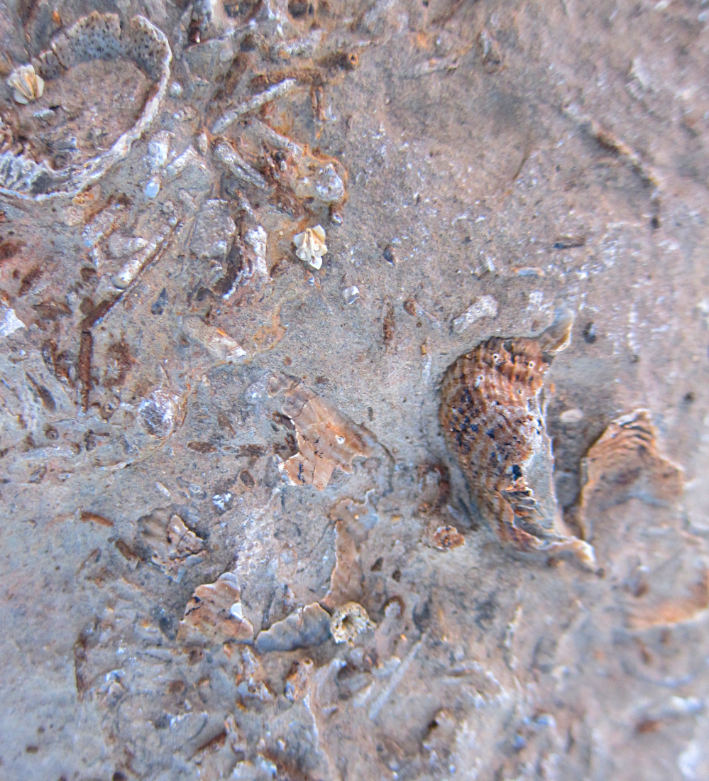
As a tourist it’s a bit of a strange place. There is no infrastructure and much of what it’s famous for has been removed to display and protect. At the trail head there are three signboards with a little bit of the information and the trail is well-marked. At the discovery site there is another sign board but nothing to really tell you where to look. Although there are still fossils, petrified wood and tracks to be found in the red stone we took a detour from the trail signs and ended up finding some marine fossils in the gray mudstone. I don’t go out of my way to research how old the rocks are that I’m seeing when I hike but when you’ve got a signboard and it’s telling you they are roughly 280 million years old it was easy to be excited at just the rocks so finding some really good marine fossils made my day.
The next day was a surprisingly abundant and unusual snow storm in Las Cruces. We had heard rain and wind all night. When it stopped we’d assumed that meant things were clearing up when in reality snow was quietly burying us on a rough dirt road. Sadly we left our camp spot earlier than we would have liked. We were taking in Lil’ Squatch for some tweaking and found ourselves without a home for several hours. I, not understanding what “wet” snow really meant, suggested that we go ahead and pass up the offered ride in favor of a slushy, no sidewalk, one mile jaunt. It turns out that the mechanic just so happened to be located around the corner from the local BLM district office. The power was out and all were leaving but, a man took pity on us and let us in for some maps. They just so happened to have a couple of the slabs from the trackways in the office and he suggested that we check out the local museum of nature and science for even better examples. He also explained that with last years Organ Mountains National Monument acquisition that the Robledo Mountains (where the tracks are found) and the Dona Ana mountains are part of that status. They’re busy trying to figure out the best way for people to gain access to these areas and how best to present the natural history to the public.


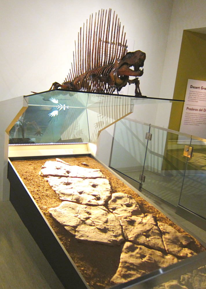
Before we headed out of town we did make a stop at the museum. It’s a new facility and they have two nicely done displays. First was a good example of the Dimetrodon skeleton that had been put together before the tracks were found and below it are the fossil tracks believed to be made by this pelycosaur. The tracks helped them realize that the animal had walked much more upright than previously understood. A long track laid out in the middle of the room also had an interactive screen where you press a list of questions and videos of Jerry MacDonald answering them played. Listening to his well delivered answers and looking at the displays brought it all together for me. With the Pangea map, his descriptions and the painting above that particular track I could begin to think about what is a pretty foreign ecology. (Read more details here:http://www.nature.nps.gov/geology/nationalfossilday/paleozoic_ptnm.cfm)


