
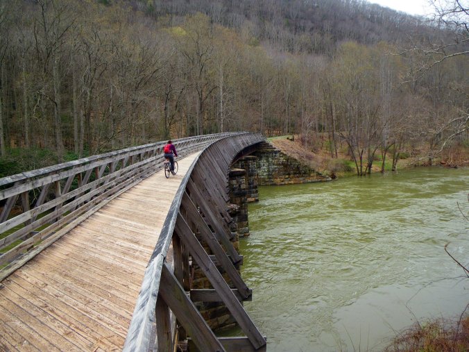
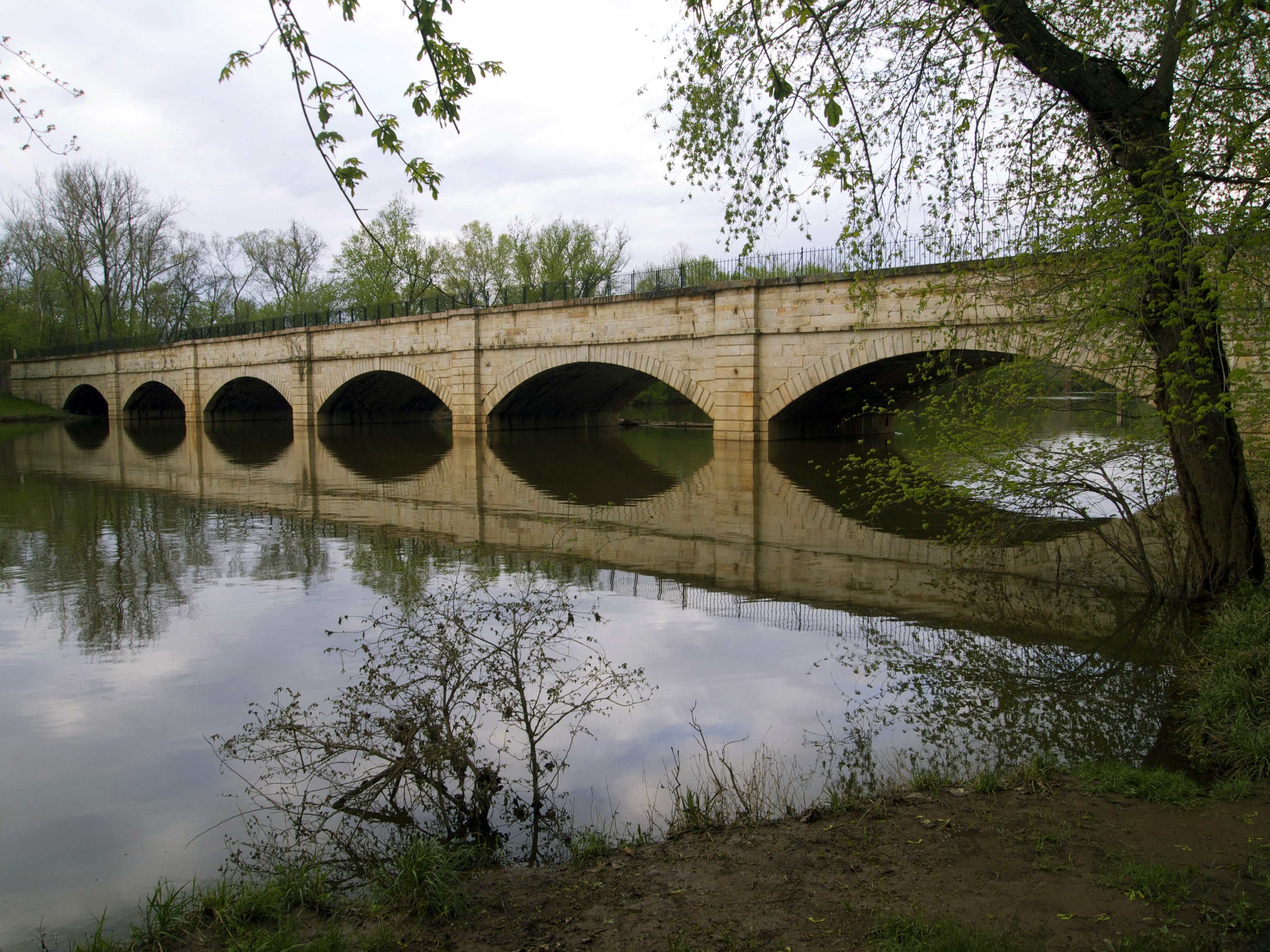
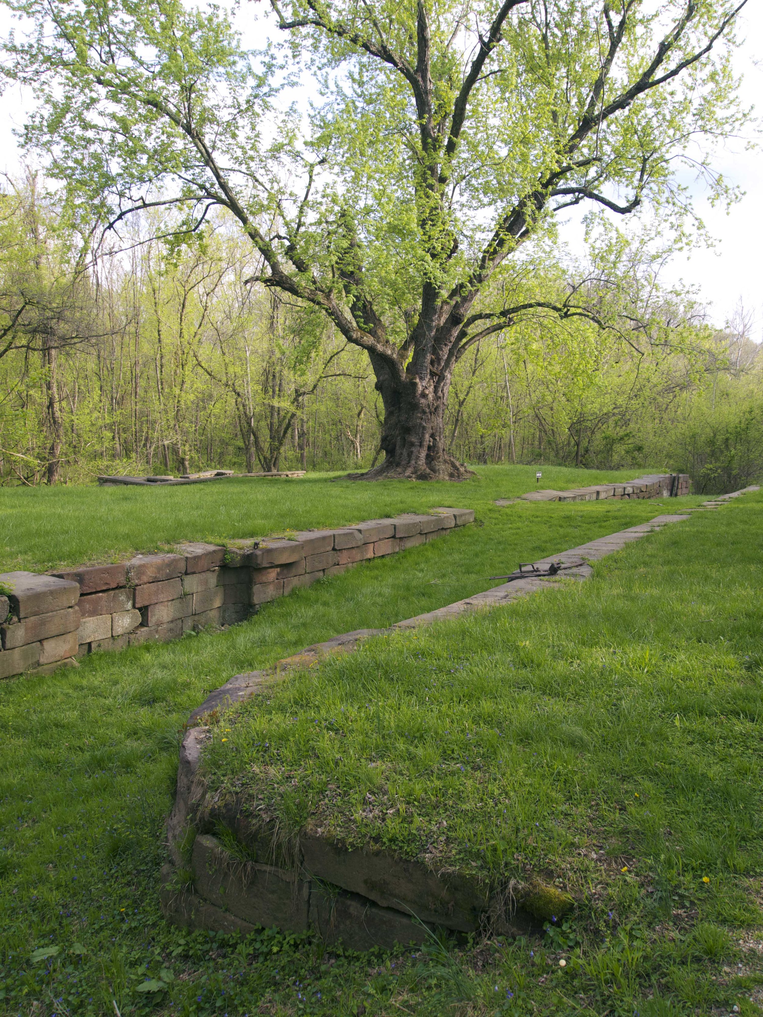
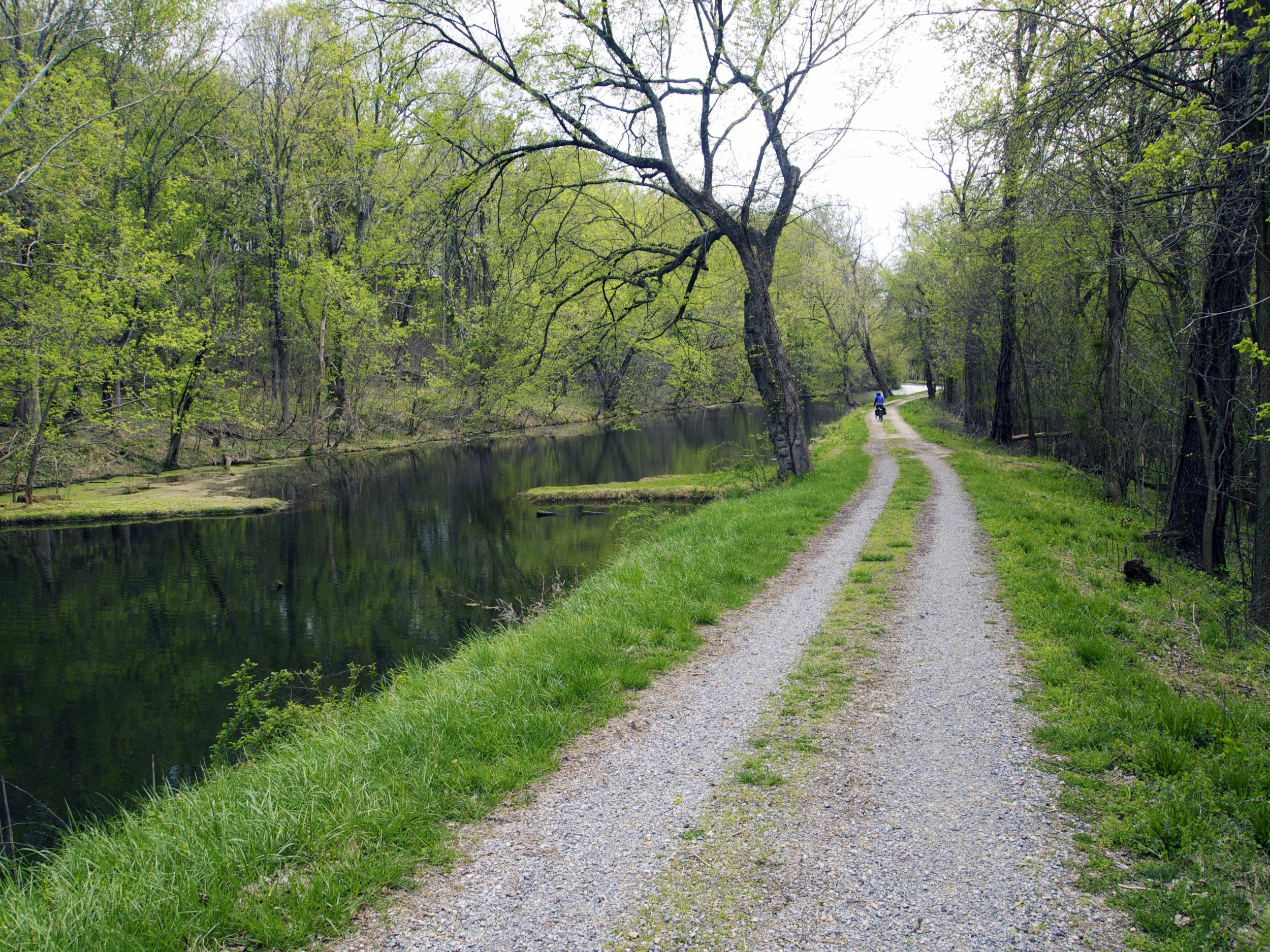
It wasn’t until the next day that I learned that the area we had been camping in is haunted. At the time I was plenty spooked by the thought of ticks so it might have been a welcome distraction to see a 19th Century highwayman with a lantern on the nearby Monocacy Aqueduct and I might have actually followed him in the attempt to find his long lost buried treasure. The place itself is a ghost. We had spent the day riding about twenty miles of towpath to get to our campsite wedged between the Potomac River and what remains of the Chesapeake and Ohio Canal. For it’s time it was a massive engineering undertaking, stretching for 184 miles from Washington DC to Cumberland MD and dug alongside the Potomac channeling the river water into a calm and controlled commercial waterway. With the newer technology of railroads literally on its heels in the form of the B & O laying tracks, sometimes on the same narrow strip of riverbank, the canal was mostly obsolete by the time investment dried up only halfway to its goal of the Ohio River. A lively culture of boat families did manage to carry a fair tonnage of cargo over the 80-some years before floods crippled the canal in 1924 but this ribbon of land has since gone decidedly feral. Except for this towpath that is.


Maintained by the National Park Service is the wide gravel bank on which mules, attached by ropes, once pulled the canal boats. With campsites every 5 miles it makes a great bike tour and if combined with the Great Allegheny Passage rail-trail becomes, in my opinion, the best way to travel the 335 miles from DC to Pittsburgh. Along the way are plenty of remnants of the old thoroughfare, from former lock keeper homes and stonework to elegant aqueducts such as the seven arch span, which in Escher-like fashion elevates this artificial river over the natural Monocacy River. What it also has is habitat. Nature has re-occupied this corridor running from our densely populated National Capitol. The canal has formed ponds where still intact or when drained has become dense with woodland making a great home for shy wildlife such as wood duck and muskrats.
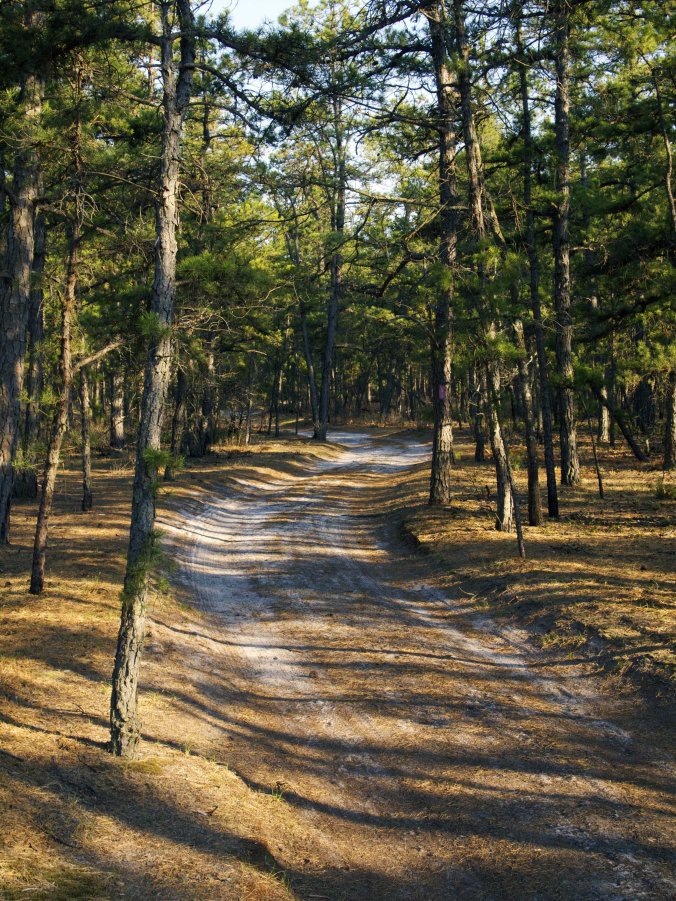
Earlier in West Virginia Rachael and I spent several days riding and camping on another piece of defunct and converted infrastructure. There we found an old railroad grade along the Greenbrier River that travels through a lightly populated valley of forest and farmland. Like the canal path this corridor was once bustling with human activity including the harvesting of much of the forest and an earlier era of less destructive coal mining. The former railroad facilitated the extraction of these resources. The need for that railroad waned as the resources were depleted and when industry moved on the forest recovered somewhat and the long gentle grade up the valley has brought new commerce in the form of travelers on bicycles, on horseback and even on haywagons.

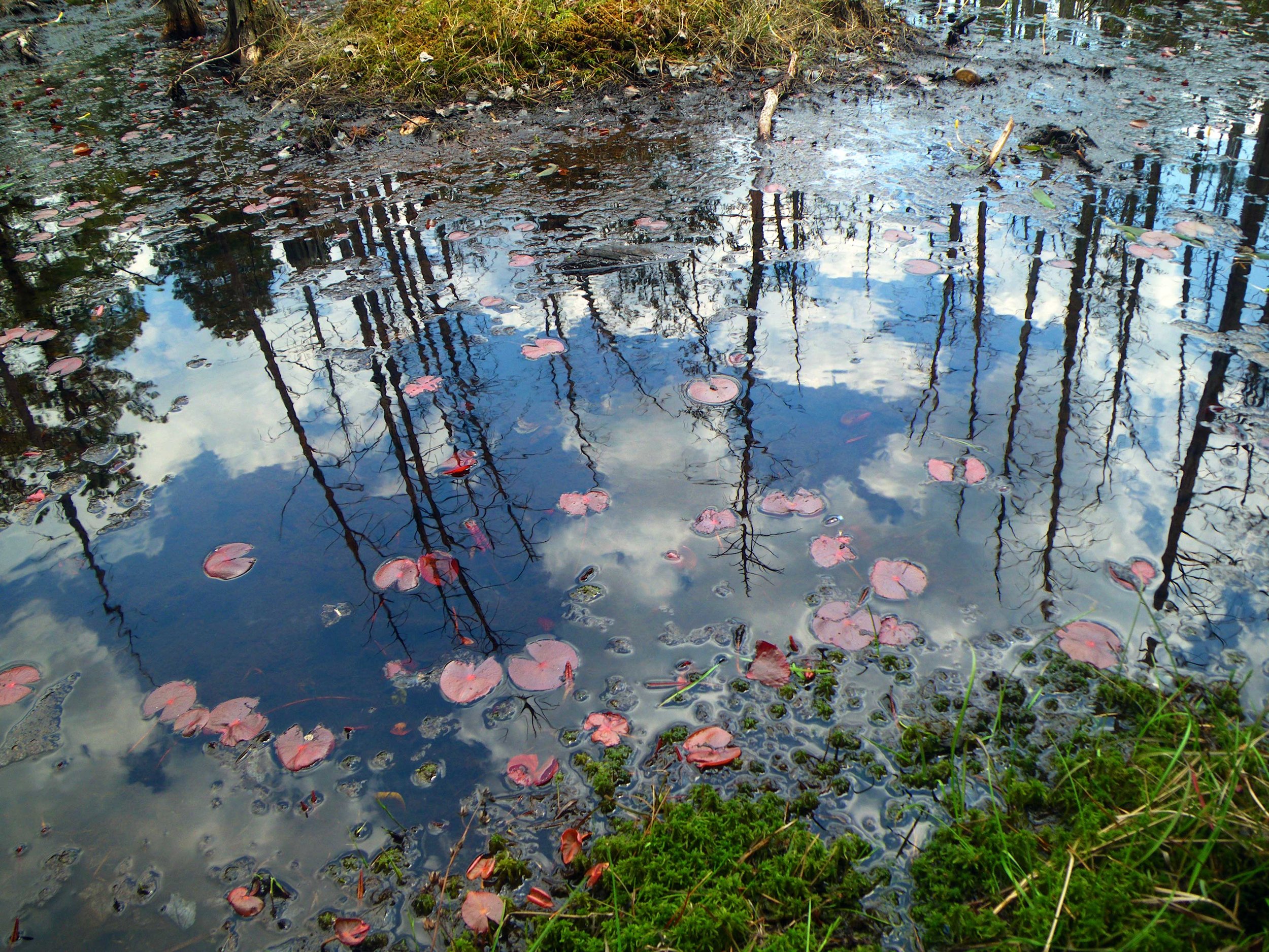
Leaving these winding paths we’ve found ourselves in a distinctly different landscape. After dropping out of the ancient and folded contours of Appalachia we found our way to the sand and low topography of The Pine Barrens in Southern New Jersey. This is a surprisingly wild place of pitch pine forest and remarkably untainted water nestled at the midpoint of the East Coast Megalopolis. What it shares with those previous stopovers is that, in the 20th century it found itself less developed than the century before, reversing the trend of pretty much any place in America. Never terribly populous because the landscape proved impossible to cultivate, it nevertheless saw early attempts at industry with “bog iron” an important source of Revolutionary cannonballs and early American wrought iron items. The pines were converted to charcoal and the sands into glass. These industries moved elsewhere and those places saw the excesses of the industrial revolution leaving “The Pines” to heal. What remains are a self-reliant “Piney” culture and an economy based on blueberry fields and cranberry bogs and tourists drawn to a rare wild place that with any luck will survive the excesses of the 21st century.


Love your blog. Did you ever read The Pine Barrens, the essay by John McPhee about the place in New Jersey? If not, let me recommend it.
LikeLike
Hi Kitty! I’ve got McPhee’s book on me right now. I’m pretty sure I first heard of the Pine Barrens when I read an excerpt some years ago. It really is a great book. I appreciate how he seems to genuinely respect the people he encounters and writes about. It was neat to be right in the middle of all he was writing about. We stayed a couple nights in the center of Wharton State Forest. Rachael should have a bit more to report with her post this afternoon.
Date: Tue, 5 May 2015 23:49:47 +0000 To: timgiller@hotmail.com
LikeLike