With access to wifi at the Grand Isle State Park we’d been watching the weather hawkishly. With all Tim’s years as a messenger he’s got his weather favorites and I tend to find his readings to be more accurate that what the computerized meteorologists spit out. Our morning ride to the restroom and back was a lovely partly cloudy sunrise and comfortable enough for just t-shirts. No sooner had we’d put our lips to our cups then the sky turned black and the wind began to rock Squatch with massive gusts. It couldn’t have been five minutes more before an e-mail popped up; subject line: WE’RE STILL ON! Having just thawed out over the day and half of nice weather we weren’t too eager to get back outside where the temperature had just dropped 25 degrees (not counting wind chill). However, we’d been looking forward to today for almost two weeks.
Back in Port Aransas Texas I searched Louisiana Coast and habitat restoration. A few clicks later and we were signing up to plant marsh grass off Port Fourchon, LA on March 5th. We’ve done many a plantings so we knew pretty much what to expect. Ha! We had no idea. I’m not sure this is an experience we are likely to duplicate.
First let me explain that coast is a loose word in these parts. The ecologically rich marsh areas are where land is a mixture of mud, sand, fresh and salt waters that extends almost as north as it does east and west. As Tim mentioned subsidence is a huge problem (for more in depth, but good reading see: http://www.americaswetlandresources.com/background_facts/detailedstory/causes.html). While it’s most pronounced in Louisiana this issue is happening on all our coasts due to America’s over zealous building of dams (recommending the documentary Dam Nation, on netflix, very well done and ends on a high note). Marshes are also huge carbon sinks. Meaning they bring in much more carbon dioxide from the air then they put out. The extra carbon dioxide goes into the mud and is trapped there for hundreds of years.

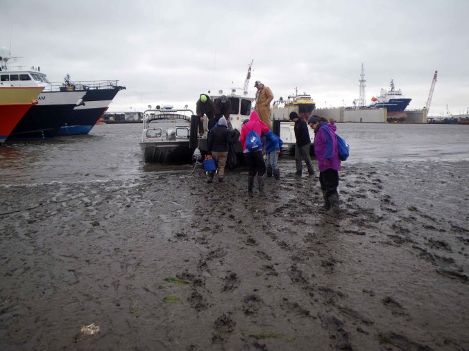
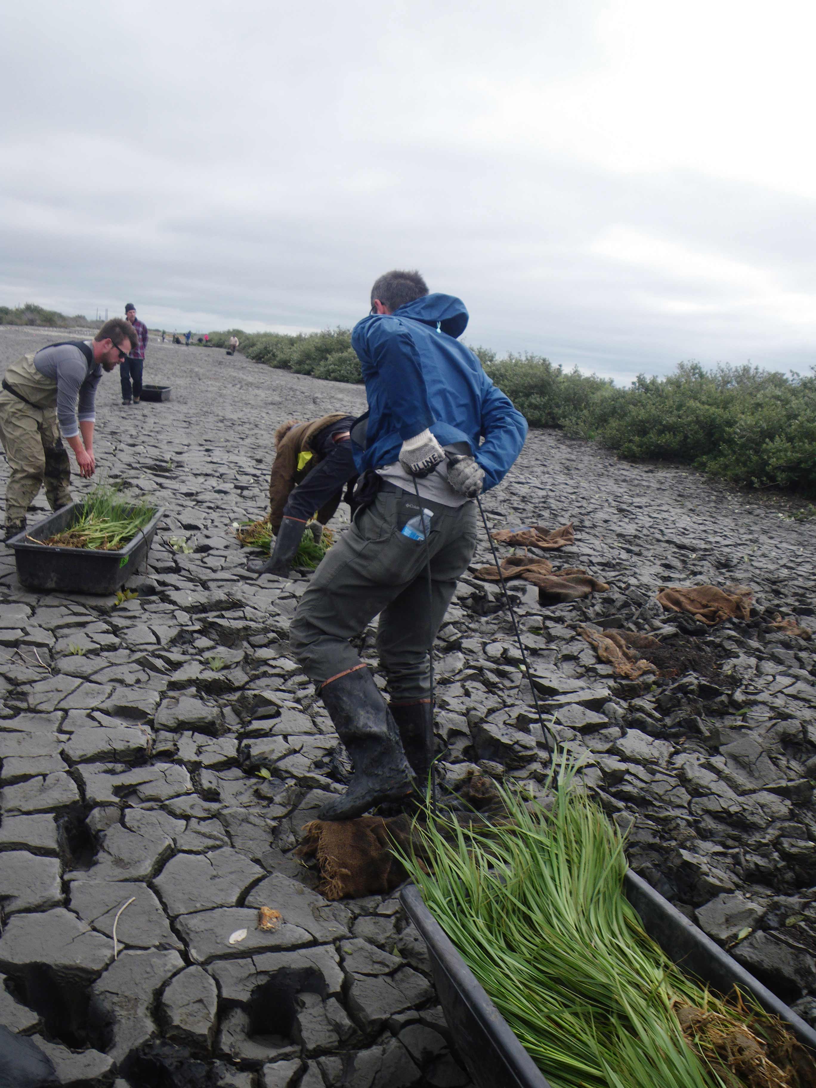
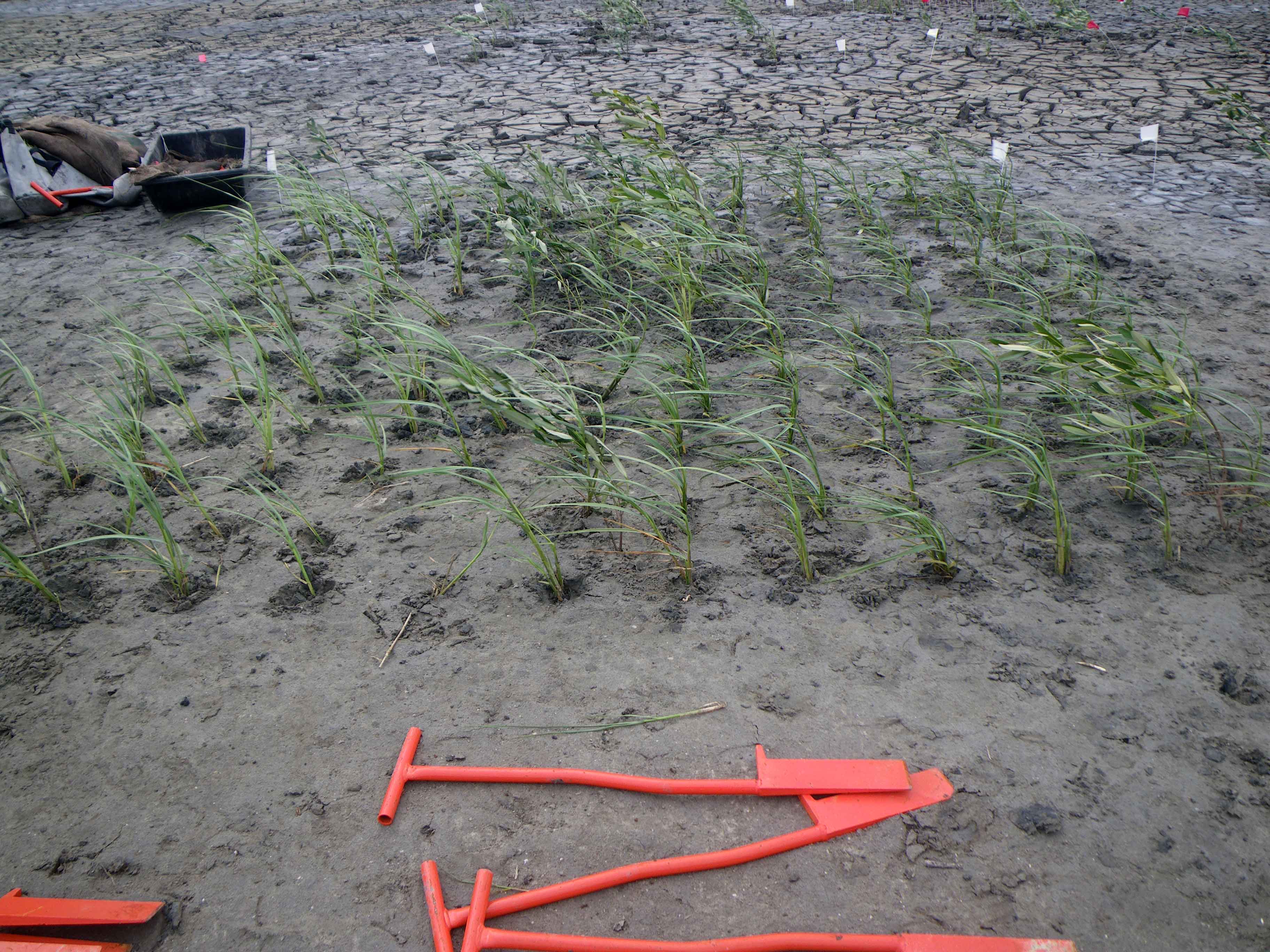
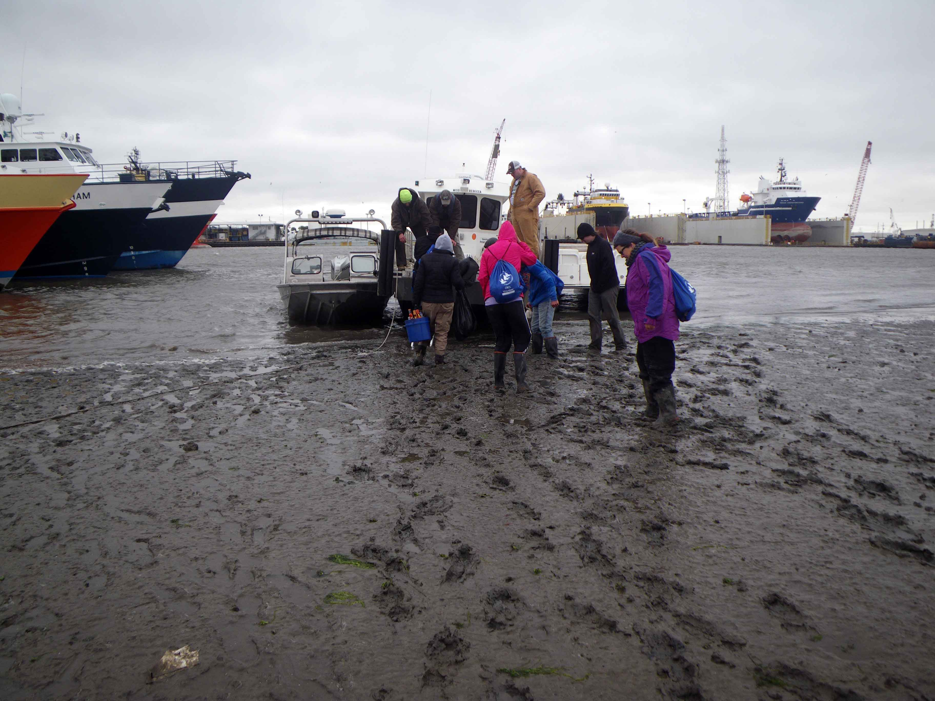
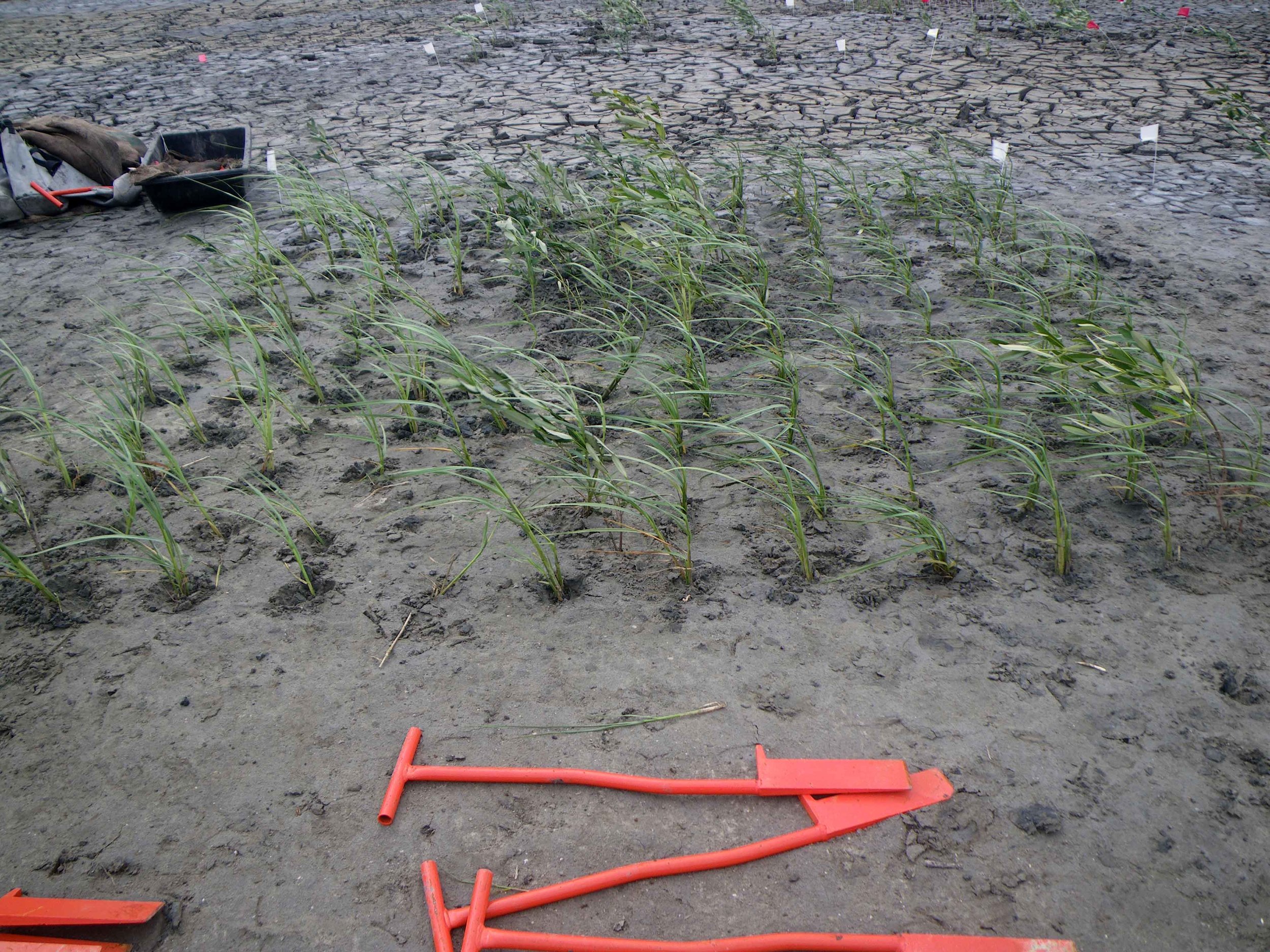
Bundled up and caffeinated we arrived at the Port Fourchon marina right on time. We signed in, packed our lunches in our sweet new Coalition to Restore Coastal Louisiana swag bag, got some knee high rubber boots and a pep talk. Then it was off to the boats! Today was a special day too. We were lucky enough to be helping to plant Smooth Blade Cordgrass (Spartina alterniflora), which we normally pull in California, and Black Mangrove (Avicennia germinans) that is being studied by three students from University of Louisiana Lafayette. The students Eric, Taylor and Laura had laid out several plots at varying elevations and densities in order to see which plots are more successful. Current restoration plantings are at approximately a 5′ plant spread. The restoration crew learned the hard way that some plants also don’t do quite as well at certain elevations and they we needing to replant the area. Other volunteers for the day included many college students, a couple of retired friends who were pretty experienced in restoration and a few fellas from Conoco Phillips who is a also financial contributor to this project. The three boats that got us to our destination, as well as the air boat that brought the sacks of plants to the site are hired hands. Add all the food, drinks, bags, boots etc and you realize that this effort needs financial fairies as much as it needs volunteers.
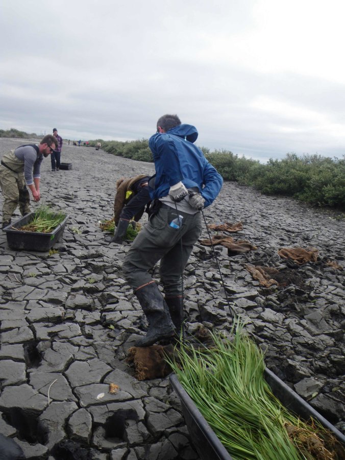
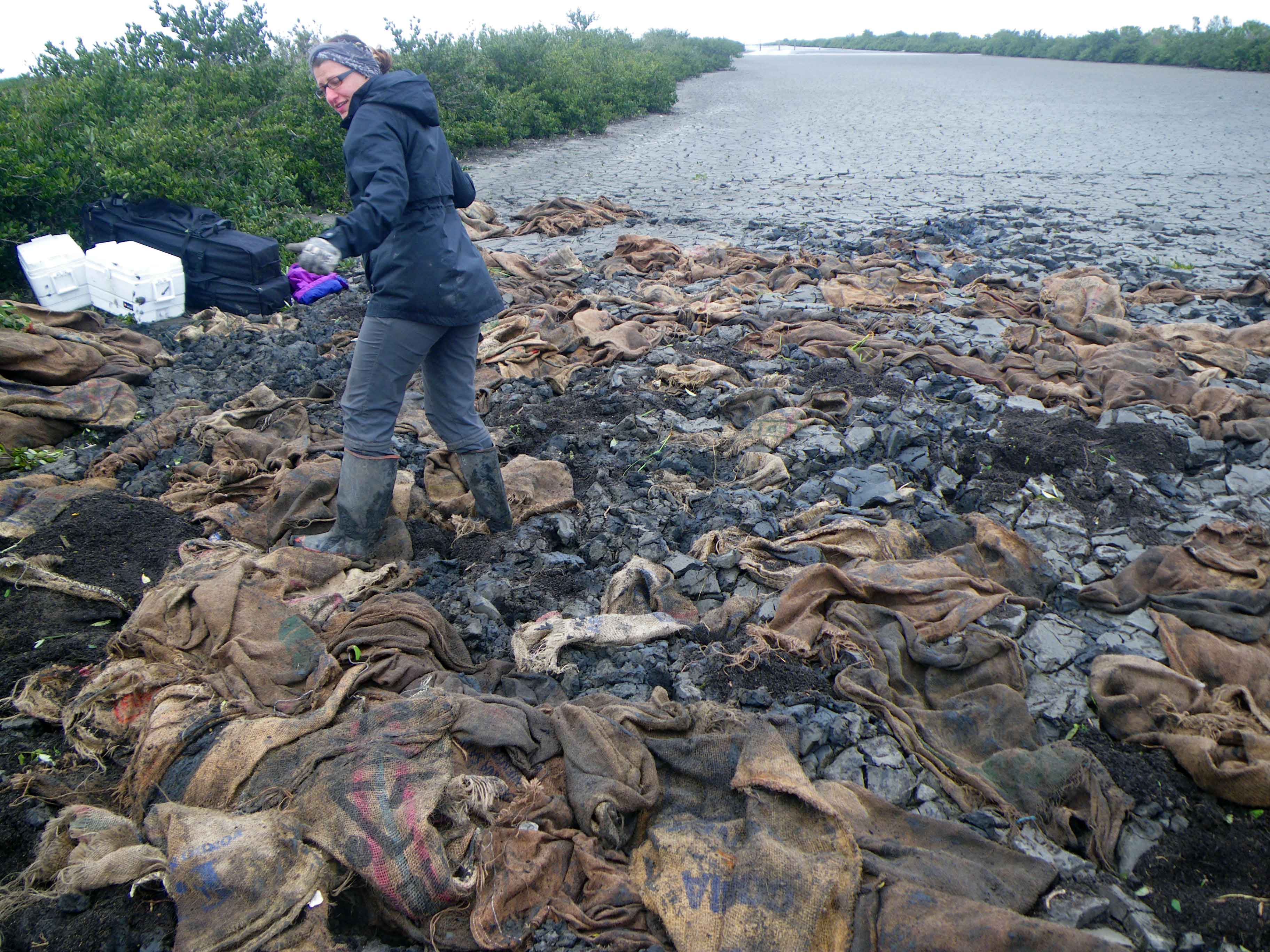
Once off the boats we walked out to our destination, a previously cut pipeline channel that had been filled back in with dredge material from the local bayous. Some of this material includes oyster shells, nails, hammers, pipes and rumoredly a still good roll of duct tape. The heavier matter falling close to where the pipe pumped it in. Mostly though it’s a mixture of mud and sand. Having been raining recently the mud on top was dried and broken in polygon fractures. Walking on it gives one a new idea of what solid ground is and added to the other worldly aura of the day. The students had laid out several planting spots with flags where we needed to insert the plant plugs. But we still needed to get the plants from where they’d been air boated in some 200 yards down the channel, most still behind a small hedge of mangroves in burlap sacks weighing some 20-25lbs each. While Tim and several others hauled sleds full of plants and other necessities I got to work with my new friend Shae and one of the students to try and get the rest of the bags out from behind the hedge.

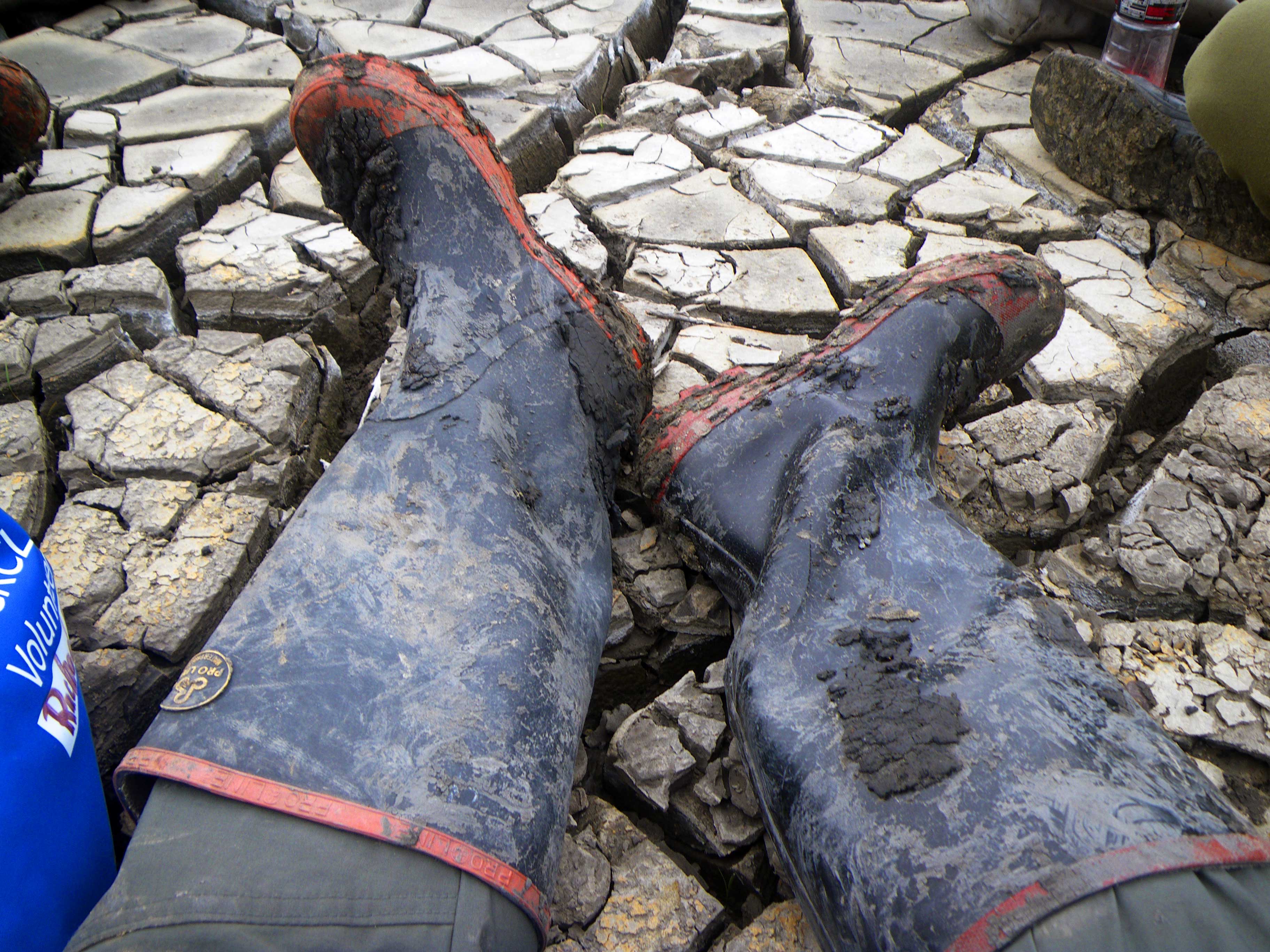
As I trudged back and forth along the quickly softening mud I was getting deeper and deeper in it. So I thought I’d stand still while the ladies brought the sacks to me and I tossed them out to be picked up. This was genius until I realized that I was over ankle deep in mud within minutes and needed to crawl forward in order to extract my boots. Shae was also falling over and had to get into deep mud to get the sacks further back. The next time the sled crew showed up I hollered out and we quickly chained ganged the sacks of plants out from the hedged area. Occasionally needing to stop the machine so that one of us could crawl out of the mud they’d inevitably sunk into. We started taking the plants out of the sacks and placing the sacks on top of the mud. Eventually with so many sacks laid out it made the area begin to feel more like trying to walk in a jump house but at least we weren’t sinking anymore. Meanwhile the wind was getting stronger and the temp dropping with every gust. By the time we started planting everyone was caked in mud and well chilled. Here’s what I love about habitat restoration volunteers though, no one complains. It’s hard dirty work yet people either love it as much as we do or don’t want to seem like they weren’t up for it. Stopping only for a quick lunch we planted a respectable amount of plants before heading back to the boats.


Sitting on the boat listening to the busy harbor radio chatter of captains and controllers, shooting the shit a bit with the students and our fellow volunteers we smiled in the comradery of the day’s work. I looked at the mud under my too long nails and looked at Tim and felt…happy.


