“Do you think Lloyd has ever accidentally dumped a vehicle into one of these farm ditches?” I asked Rachael.  I reached for the steering wheel and my foot was searching for the brake pedal even though I knew it was pointless. We had put our faith in the fact that Lloyd and his assistant Darren knew what they were doing out on these patched and potholed backcountry Louisiana farm roads, however my equilibrium had taken a lot of hours getting used to the suspension on Lil’ Squatch and being an extra five feet off the ground made going into an bumpy, off-camber turn feel more dangerous than a county fair rollercoaster that was missing a few cotter pins. And almost as fun. “I don’t think this is legal in California” said Rachael. “Uh-uh. Bet it ain’t legal here either, but here we are.” I had to admit that not only was it kind of pleasant to be sitting back and letting someone else cart us along but also the view was pretty great being this high off the ground. Unfortunately we were up on the back of Lloyd’s truck because Squatch’s water pump had seized about 3 miles from the Poverty Point archaeological site (a name that caused the truck dispatcher to chuckle unsympathetically) and we were being taken into his small town shop to fix it.

Poverty Point – Photo by Tim Giller
Poverty Point has one of the tallest and most ancient of the mounds built in the Mississippi river drainage and it is flanked by rows of semicircular ridges constructed around a huge plaza. With the higher vantage we had from the cab I started wondering if they moved around those incredible quantities of dirt just so they could get a better view of the landscape. A couple days earlier we had climbed Emerald mound on the other side of the Mississippi River. I knew that these two structures at over 65 feet tall traded claims of being the second largest pre-Columbian mounds but what I hadn’t yet learned was that the culture at Poverty Point had begun construction 1000 years before the Pyramids in Egypt had been built while Emerald mound had been created much later and was still in active use when Spanish and French explorers ventured into the region. These two sites are sort of bookends of a cultural phenomenon that spanned several thousand years, most of the length of the largest river on the continent and began with hunter-gatherers in what is now Louisiana. The fecund landscape provided by the flows of the Mississippi and the rich Southeastern forests offered foods from fish and crawdads out of the bayous to nuts, plants deer and bear in the woodlands.
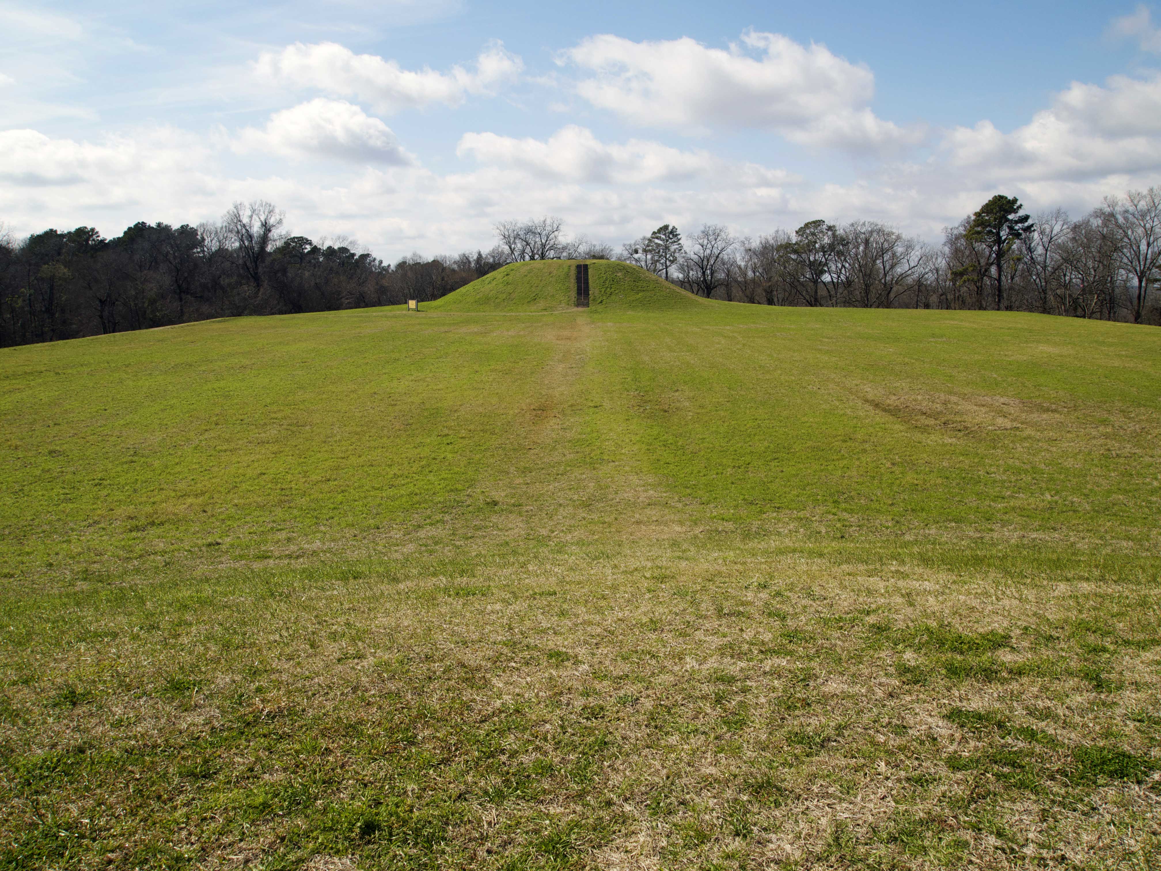
Emerald Mound – Photo by Tim Giller
These town sites and ceremonial structures have survived in an ever-morphing landscape of shifting river channels, mysterious and languid bayous and massive and regular flooding. They were built by people who respected the power of water and recognized the abundance that came from the replenishment provided by the Mississippi River. This civilization was comparable to the Aztecs or Mayans further south and had towns larger than any Colonial city would achieve until the 19th century, yet by the time that frontiersmen were settling in the region the population had fallen dramatically, most likely ravaged by European diseases acquired from those first visitors. Without advocates for the land and culture it was literally plowed under. Mounds and platforms are abundant in the region but often hidden in forest groves, covered by crops or with pioneer homes built atop them, a recognition of the value of higher ground.
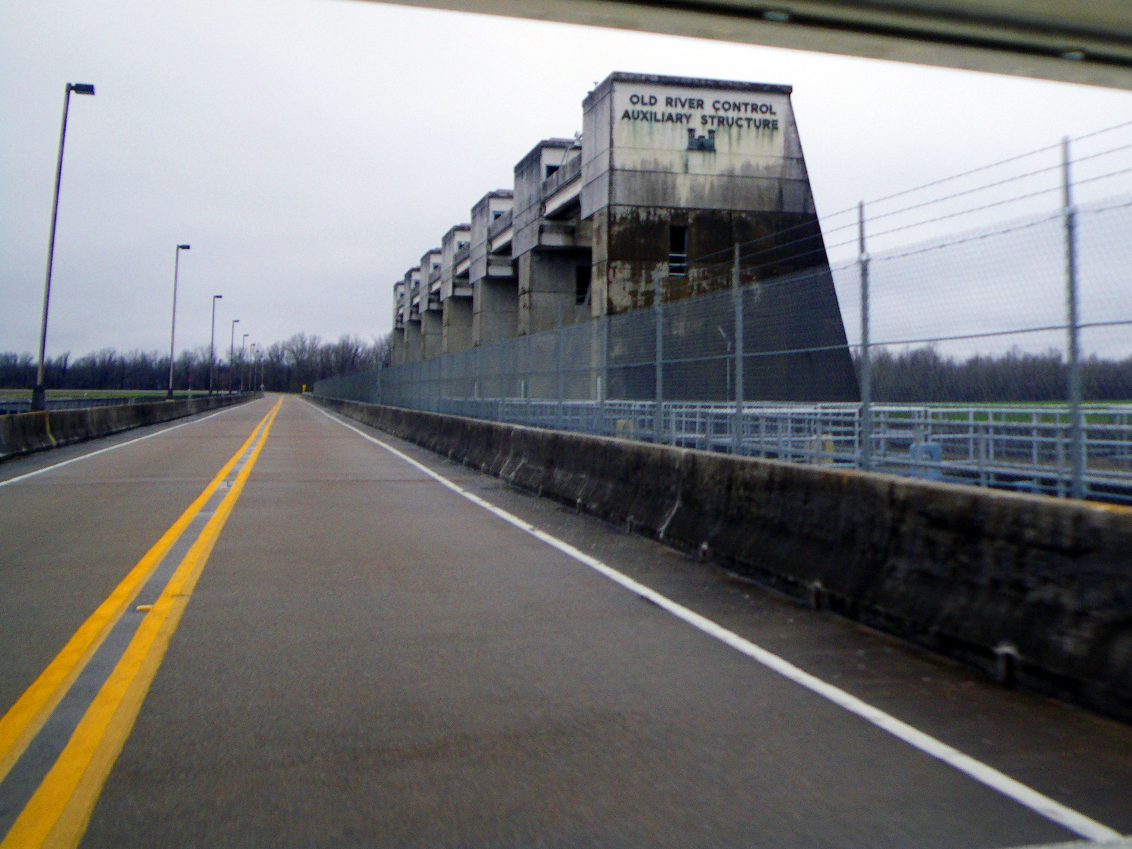
Army Corp Dam, Louisiana – Photo Bt Tim Giller
With our little guy patched up Rachael and I had an engagement to get to on the tenuous southern edge of Louisiana. I suppose after walking among the remnants of mysterious earthworks my eyes had become sensitive to the altered shapes of the landscape. However, it would have been hard to miss the massive plumbing that the Army Corp of Engineers and others have created in this flood prone environment and it was startling in contrast. Moving south along the Mississippi you can find yourself on a road high atop a berm that extends hundreds of miles in an attempt to keep this workhorse of a river just where we want it. Then upon descending the levees we found ourselves skirting back basins and crossing the channels, dams and locks of a vast system of flood control and navigation infrastructure. This monumental yoking of nature was exactly why we found ourselves at the once expanding foot of the continent. It is likely we are asking too much of these waters. Our mixed purposes of large-scale transportation and protecting fertile and populated farmland have stifled the regenerative system that brought this abundance to the region. The river system wants to spill out chaotically. It needs too. Those silt-laden waters of the “The Big Muddy” created half of the state over the past few thousand years. Today Louisiana loses two football fields an hour. The causes of this loss are multi-faceted but it is clear that human activity is the major culprit. Those sediment rich Mississippi waters are flushed out to the deep Gulf through the channelized waterway. A vast number of channels for the oil and gas industry have created saltwater intrusion pathways that spread erosion. Even an invasive South American rodent called nutria, brought here to produce furs, have exploded in numbers consuming a large amount of vegetation that would otherwise contribute to soil build up. 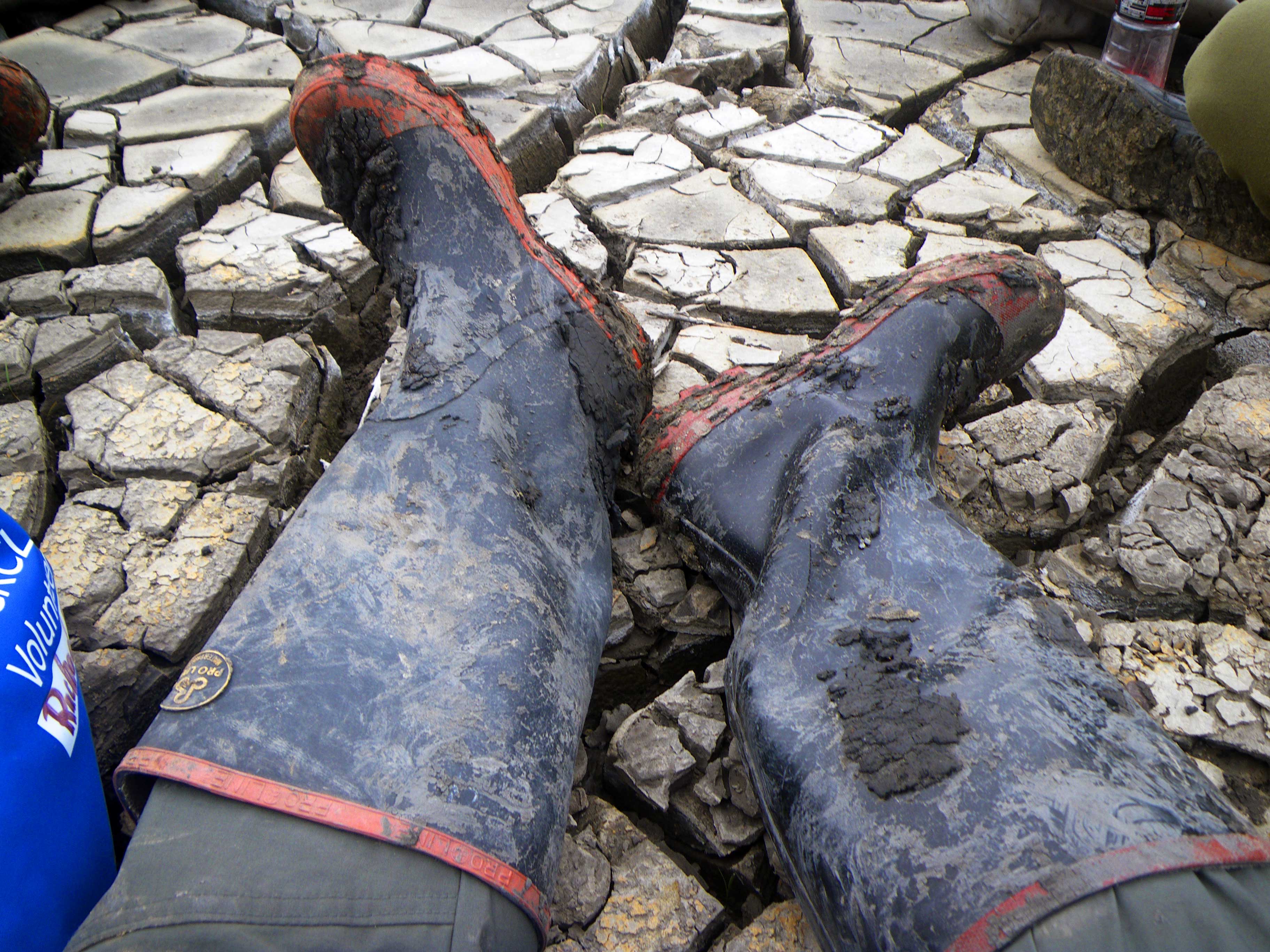 This ethereal Gulf Coast edge of sandy barrier islands and once sprawling marshland is also what protects the region from hurricanes and their storm surges so a lot of players have a stake in this. Fishermen, lowland farmers, coastal dwellers and even the shipping and petroleum industries see the value in regenerating this natural buffer. Projected sea level rise only makes this more urgent. This is how we found ourselves lucky enough to spend a cold, windy day getting knee deep in boot swallowing mud with a motley bunch of people. Volunteers are not only trying to put a dent in the loss of these wetlands but we also hope that studying this work will teach us to do it most effectively. As I dragged a hundred pound sled loaded with mangrove and cordgrass along an old pipeline channel I couldn’t help feeling some connection to the long lost people who piled baskets full by the millions into elaborate and now mysterious mounds.

Thanks for another great story. Last year when I was in Louisiana and Pam was in Savannah, I took a drive down state highway one to the furthest point south in Louisiana that one could drive. It took me to Grand Island with all of the homes and most business built on stilts. It was like driving on a sponge. Might you be going there?
David
LikeLike